North Tazewell in Tazewell County, Virginia — The American South (Mid-Atlantic)
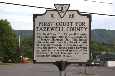
First Court for Tazewell County
Erected 1987 by Department of Conservation and Historic Resources. (Marker Number X-28.)
Topics and series. This historical marker is listed in this topic list: Political Subdivisions. In addition, it is included in the Virginia Department of Historic Resources (DHR) series list. A significant historical month for this entry is June 1800.
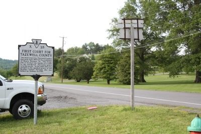
Location. 37° 8.205′ N, 81° 29.318′ W. Marker is in North Tazewell, Virginia, in Tazewell County. Marker is at the intersection of Fincastle Turnpike (Business U.S. 460) and Dial Rock Road on Fincastle Turnpike. Touch for map. Marker is at or near this postal address: 1105 E Fincastle St, North Tazewell VA 24630, United States of America. Touch for directions.
Other nearby markers. At least 8 other markers are within 5 miles of this marker, measured as the crow flies. William Wynne’s Fort (approx. 0.9 miles away); Molly Tynes’s Ride (approx. 1˝ miles away); Burke’s Garden (approx. 1˝ miles away); The James Wynn House (approx. 2.3 miles away); Tazewell (approx. 2˝ miles away); Indian-Settler Conflicts (approx. 4.3 miles away); Pisgah United Methodist Church (approx. 4.8 miles away); Big Crab Orchard or Witten’s Fort (approx. 4.8 miles away).
Credits. This page was last revised on June 16, 2016. It was originally submitted on July 17, 2011, by J. J. Prats of Powell, Ohio. This page has been viewed 822 times since then and 27 times this year. Photos: 1, 2. submitted on July 17, 2011, by J. J. Prats of Powell, Ohio.
Editor’s want-list for this marker. Photo of the house site • Photo of Henry Harman Jr.'s grave and that of his brother Daniel • Can you help?

