Zion Crossroads in Louisa County, Virginia — The American South (Mid-Atlantic)
Louisa County / Fluvanna County
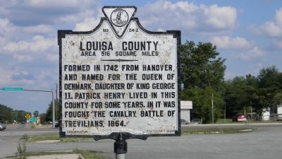
Louisa County. Area 516 Square Miles. Formed in 1742 from Hanover, and named for the Queen of Denmark, Daughter of King George II. Patrick Henry lived in this county for some years. In it was fought the cavalry Battle of Trevilians, 1864.
Fluvanna County.
Erected 1928 by Conservation Commission. (Marker Number Z-24.)
Topics and series. This historical marker is listed in these topic lists: Patriots & Patriotism • Political Subdivisions • War, US Civil. In addition, it is included in the Virginia Department of Historic Resources (DHR) series list. A significant historical year for this entry is 1742.
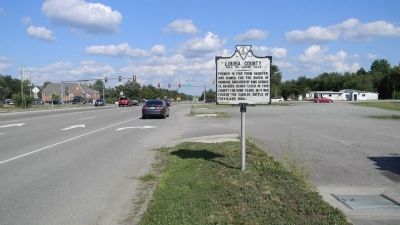
Location. 37° 58.253′ N, 78° 13.229′ W. Marker is in Zion Crossroads, Virginia, in Louisa County. Marker is on Richmond Road (U.S. 250) 0.1 miles west of James Madison Highway (U.S. 15), on the right when traveling east. Touch for map. Marker is in this post office area: Gordonsville VA 22942, United States of America. Touch for directions.
Other nearby markers. At least 8 other markers are within 8 miles of this marker, measured as the crow flies. A different marker also named Louisa County / Fluvanna County (about 400 feet away, measured in a direct line); Flora Molton (about 600 feet away); Campaign of 1781 (approx. 3.3 miles away); The “Regular” Methodist Conference (approx. 6 miles away); a different marker also named Campaign of 1781 (approx. 6˝ miles away); Albemarle County / Louisa County (approx. 6.7 miles away); Revolutionary War Campaign of 1781 (approx. 6.7 miles away); Boswell’s Tavern (approx. 7.1 miles away). Touch for a list and map of all markers in Zion Crossroads.
Credits. This page was last revised on July 8, 2021. It was originally submitted on July 18, 2011, by David Ross of Pequannock, New Jersey. This page has been viewed 709 times since then and 21 times this year. Photos: 1, 2. submitted on July 18, 2011, by David Ross of Pequannock, New Jersey. • Craig Swain was the editor who published this page.
Editor’s want-list for this marker. Other side of Marker. • Can you help?

