Boston Township in Peninsula in Summit County, Ohio — The American Midwest (Great Lakes)
Linking the Wilderness to the World
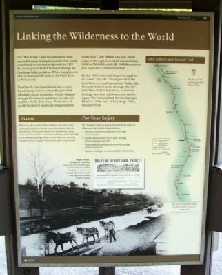
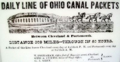
The Ohio & Erie Canal was among the most successful canals during the periods when canals contributed to our nation's growth. In 1827 the canal opened from Cleveland through the Cuyahoga Valley to Akron. When completed in 1832 it stretched 308 miles to the Ohio River at Portsmouth.
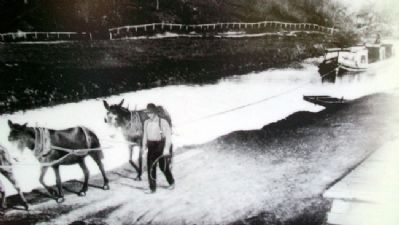
The Ohio & Erie Canal linked into a water-based transportation system that provided affordable access to markets. Goods shipped through Cleveland headed east via Lake Erie and New York's Erie Canal. Production of goods boomed to supply growing industries on the East Coast. Within one year, wheat shipped through Cleveland increased from 1,000 to 250,000 bushels. By 1840 the number had soared to 2.2 million bushels.
By the 1850s railroads began to supplant the canal. The 1913 flood provided the final blow to canal operations. Today, the Towpath Trail extends through the 110-mile Ohio & Erie Canalway, a national heritage area that celebrates the canal's legacy. The National Park Service manages 20 miles of the trail in Cuyahoga Valley National Park.
Access
Within Cuyahoga Valley National Park, the trail is level and hard-packed for visitors using wheelchairs, bicycles, and strollers. Motorized vehicles are prohibited, except motorized wheelchairs. Consider combining your visit with a trip aboard Cuyahoga Valley Scenic Railroad, traveling one way on the Towpath Trail and the other way by train.
Erected by National Park Service, U.S. Department of the Interior.
Topics. This historical marker is listed in these topic lists: Industry & Commerce • Man-Made Features • Settlements & Settlers • Waterways & Vessels. A significant historical year for this entry is 1827.
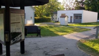
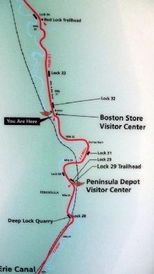
Location. Marker has been permanently removed. It was located near 41° 15.774′ N, 81° 33.51′ W. Marker was in Peninsula, Ohio, in Summit County. It was in Boston Township. Marker could be reached from Ohio & Erie Canal Towpath south of Boston Mills Road (County Road 32), on the right when traveling south. Marker is on the path leading from the parking lot to the Cuyahoga Valley National Park's Boston Store Visitor Center, off Boston Mills Road, about 700 feet east of Riverview Road. Touch for map. Marker was at or near this postal address: 1550 Boston Mills Rd, Peninsula OH 44264, United States of America.
We have been informed that this sign or monument is no longer there and will not be replaced. This page is an archival view of what was.
Other nearby markers. At least 8 other markers are within walking distance of this location. Welcome to the Cuyahoga Valley National Park
(a few steps from this marker); Ohio & Erie Canalway (a few steps from this marker); Early 1900s Boston (within shouting distance of this marker); Building a Canal Boat (within shouting distance of this marker); Fortunes Rise and Fall (within shouting distance of this marker); Bustling Boat-Building Village (within shouting distance of this marker); Welcome to Cuyahoga Valley National Park (about 300 feet away, measured in a direct line); A River Renewed (about 500 feet away).
Also see . . .
1. The Ohio and Erie Canalway. Website homepage (Submitted on July 23, 2011, by William Fischer, Jr. of Scranton, Pennsylvania.)
2. Cuyahoga Valley National Park. National Park Service website entry (Submitted on July 23, 2011, by William Fischer, Jr. of Scranton, Pennsylvania.)
3. The Ohio & Erie Canal: Catalyst of Economic Development for Ohio. National Park Service website entry (Submitted on July 23, 2011, by William Fischer, Jr. of Scranton, Pennsylvania.)
Credits. This page was last revised on May 30, 2023. It was originally submitted on July 23, 2011, by William Fischer, Jr. of Scranton, Pennsylvania. This page has been viewed 420 times since then and 4 times this year. Last updated on May 29, 2023, by Craig Doda of Napoleon, Ohio. Photos: 1, 2, 3, 4, 5. submitted on July 23, 2011, by William Fischer, Jr. of Scranton, Pennsylvania. • Devry Becker Jones was the editor who published this page.
