Council Grove in Morris County, Kansas — The American Midwest (Upper Plains)
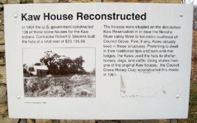
Kaw House Reconstructed
In 1861 the U.S. government constructed 138 of these stone houses for the Kaw Indians. Contractor Robert S. Stevens built the huts at a total cost of $33,135.98.
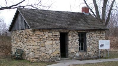
The houses were situated on the diminished Kaw Reservation in or near the Neosho River valley three to ten miles southeast of Council Grove. Few, if any, Kaws actually lived in these structures. Preferring to dwell in their traditional tipis and bark-and-mat lodges, the Kaws used the huts to shelter horses, dogs, and cattle. Using stone from one of the original Kaw houses, the Council Grove Rotary Club reconstructed this model in 1961.
Erected by Council Grove Rotary Club and Kaw Mission State Historic Site.
Topics and series. This historical marker is listed in these topic lists: Native Americans • Settlements & Settlers. In addition, it is included in the Rotary International series list. A significant historical year for this entry is 1861.
Location. 38° 39.95′ N, 96° 29.614′ W. Marker is in Council Grove, Kansas, in Morris County. Marker is on Mission Street near Huffaker Street, on the right when traveling north. Marker and house are on the grounds of the Kaw Mission State Historic Site. Touch for map. Marker is at or near this postal address: 500 North Mission Street, Council Grove KS 66846, United States of America. Touch for directions.
Other nearby markers. At least 8 other markers are within walking distance of this marker. Mill Stone (a few steps from this marker); Kaw Mission (a few steps from this marker); The Mormon Battalion at Council Grove, Kansas (a few steps from this marker); Hermit's Cave (approx. ¼ mile away); a different marker also named Hermit's Cave (approx. ¼ mile away); Old Bell (approx. 0.3 miles away); The Cottage House Hotel and Motel (approx. 0.3 miles away); Neosho Crossing (approx. 0.3 miles away). Touch for a list and map of all markers in Council Grove.
Also see . . .
1. The Kaw Nation. Tribe website homepage (Submitted on July 25, 2011, by William Fischer, Jr. of Scranton, Pennsylvania.)
2. Our Rich History. Council Grove Area Trade & Tourism Association website entry (Submitted on July 25, 2011, by William Fischer, Jr. of Scranton, Pennsylvania.)
3. 8 Wonders of Kansas History: Council Grove, Santa Fe Trail National Historic Landmark. Kansas Sampler Foundation website entry (Submitted on January 25, 2022, by Larry Gertner of New York, New York.)
Credits. This page was last revised on August 29, 2023. It was originally submitted on July 25, 2011, by William Fischer, Jr. of Scranton, Pennsylvania. This page has been viewed 554 times since then and 45 times this year. Photos: 1, 2. submitted on July 25, 2011, by William Fischer, Jr. of Scranton, Pennsylvania.

