Near Kit Carson in Amador County, California — The American West (Pacific Coastal)
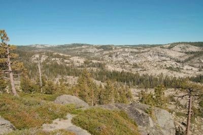
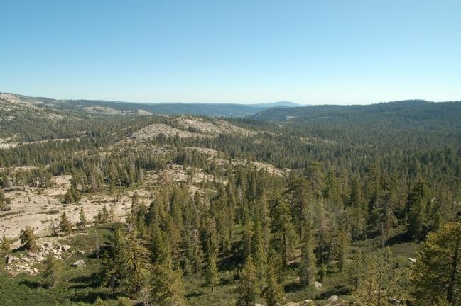
Peddler Hill Overlook
Inscription.
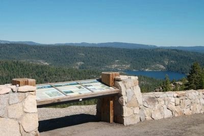
This marker is made up of three separate panels.
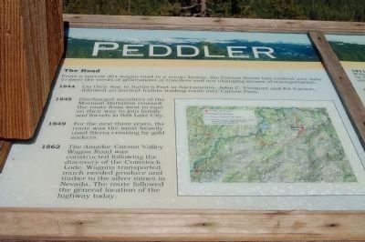
[Panel 1:]
The Road
From a narrow dirt wagon road to a scenic byway, the Carson Route has evolved over time to meet the needs of generations of travelers and our changing means of transportation.
1844 - On their way to Sutter’s Fort in Sacramento, John C. Fremont and Kit Carson, followed and ancient Indian trading route over Carson Pass.
1848 - Discharged members of the Mormon Battalion crossed the route from west to east on their way to join family and friends in Salt Lake City.
1949 - For the next three years, the route was the most heavily used Sierra crossing by gold seekers.
1862 - The Amador Carson Valley Wagon Road was constructed following the discovery of the Comstock Lode. Wagons transported much needed produce and timber to the silver mines in Nevada. The route followed the general location of the highway today.
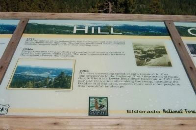
[Panel 2:]
1911 - With the advent of the automobile, the old wagon road was replaced by the Alpine State Highway. The narrow windy road accommodated animals, wagons and the first slow moving cars.
1930s - Faster cars and the popularity of recreational touring created a need for straighter, wider roads. The new improvements included the original Peddler Hill overlook.
1958 - The ever increasing speed of cars required further improvements to the highway. The construction of Pacific Gas and Electric’s Lower Bear River Reservoir in 1951 and day use recreation sites along the route, including the Peddler Hill Ski area, enticed more and more people to this beautiful landscape.
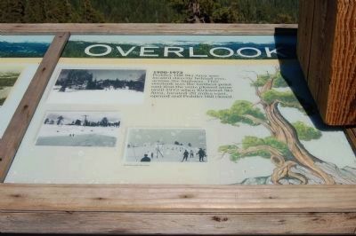
[Panel 3:]
1950-1972 - Peddler Hill Ski Area was located directly behind you, across the highway. This overlook was the farthest point east that the state plowed snow until 1972 when Kirkwood Ski Area, located 20 miles east, opened and Peddler Hill closed.
Erected by National Forest Service - Eldorado National Forest.
Topics. This historical marker is listed in these topic lists: Parks & Recreational Areas • Roads & Vehicles • Sports. A significant historical year for this entry is 1844.
Location. Marker is missing. It was located near 38° 33.892′ N, 120° 15.967′ W. Marker was near Kit Carson, California, in Amador County. Marker was on Carson Pass (State Highway 88), on the right when traveling east. Touch for map. Marker was in this post office area: Kit Carson CA 95644, United States of America. Touch for directions.
Other nearby markers. At least 8 other markers are within 9 miles of this location, measured as the crow flies. Carson Trail - Leek Springs (approx. 5.3 miles away); Ham's Station
(approx. 6.2 miles away); Maiden's Grave (approx. 6.9 miles away); Tragedy Spring (approx. 8.3 miles away); Old Emigrant Road (approx. 8.3 miles away); Mormon-Carson Pass Emigrant Trail (approx. 8.8 miles away); Plasse Resort (approx. 9.1 miles away); Plasse’s Trading Post (approx. 9.1 miles away). Touch for a list and map of all markers in Kit Carson.
More about this marker. The markers were noticed to be missing while driving by the area. This can also be seen on Google Maps.
Additional keywords. winter sports
Credits. This page was last revised on May 18, 2023. It was originally submitted on July 25, 2011, by Barry Swackhamer of Brentwood, California. This page has been viewed 2,283 times since then and 139 times this year. Photos: 1, 2, 3, 4, 5, 6. submitted on July 25, 2011, by Barry Swackhamer of Brentwood, California. • Syd Whittle was the editor who published this page.
