Near Hartwell in Hart County, Georgia — The American South (South Atlantic)
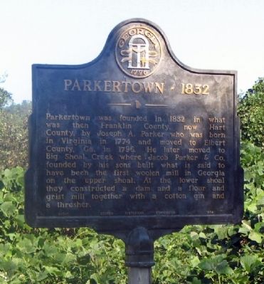
Parkertown - 1832
Erected 1954 by Georgia Historical Commission. (Marker Number 073-1.)
Topics and series. This historical marker is listed in these topic lists: Industry & Commerce • Settlements & Settlers. In addition, it is included in the Georgia Historical Society series list. A significant historical year for this entry is 1832.
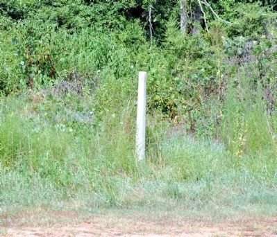
Location. Marker has been reported missing. It was located near 34° 27.617′ N, 83° 2.502′ W. Marker was near Hartwell, Georgia, in Hart County. Marker was on Shoal Creek Church Road (County Route 245) 0 miles south of Bill Lucas Road, on the right when traveling north. Touch for map. Marker was in this post office area: Hartwell GA 30643, United States of America. Touch for directions.
Other nearby markers. At least 8 other markers are within 9 miles of this location, measured as the crow flies. Shoal Creek (approx. 1˝ miles away); Vandiver Bridge (approx. 1.9 miles away in South Carolina); Poplar Springs Baptist Church (approx. 5 miles away); Beaverdam Baptist Church (approx. 5.1 miles away in South Carolina); Capt. Samuel Earle (approx. 7.9 miles away in South Carolina); Red Hollow Road (approx. 8.3 miles away); Double Branches Baptist Church (approx. 8.3 miles away); Nazareth on the Beaverdam Presbyterian Church / Townville Presbyterian Church (approx. 8.4 miles away in South Carolina).
Credits. This page was last revised on January 30, 2020. It was originally submitted on August 3, 2009, by David Seibert of Sandy Springs, Georgia. This page has been viewed 1,385 times since then and 43 times this year. Last updated on July 26, 2011, by David Seibert of Sandy Springs, Georgia. Photos: 1. submitted on August 3, 2009, by David Seibert of Sandy Springs, Georgia. 2. submitted on July 26, 2011, by David Seibert of Sandy Springs, Georgia. • Kevin W. was the editor who published this page.

