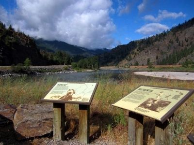
Paradise in Sanders County, Montana — The American West (Mountains)
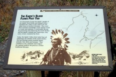
The Earth's Blood Flows Past You
Clark Fork Corridor: The River
Today, the Sqelixw follow their belief that all waterways are arteries of the Earth Mother. The fast-flowing waters nourish plants, animals, fish, birds and humans. They continue to use, maintain and respect the natural world in the practice of their traditional lifeways.
Antoine Chief Eagle
(1865-1936)
A member of the Pend Oreille tribe, Antoine was known for setting long, narrow, reed traps to harvest fish from the numerous rivers and streams in this area.
Erected by Lolo National Forest.
Topics. This historical marker is listed in these topic lists: Native Americans • Waterways & Vessels.
Location. 47° 19.046′ N, 114° 48.283′ W. Marker is in Paradise, Montana, in Sanders County. Marker is on State Highway 135, 3.3 miles south of State Highway 200, on the right when traveling south. Touch for map. Marker is in this post office area: Paradise MT 59856, United States of America. Touch for directions.
Other nearby markers. At least 8 other markers are within 11 miles of this marker, measured as the crow flies. Native People Sustained Through Many Millennia (here, next to this marker); Phantom Formation Is Rock Solid In Corridor (a few steps from this marker); Coursing Through Miles Of Montana (approx. 1.9 miles away); Searching For Fur And A Finer Life (approx. 1.9 miles away); Wildlife Thrive In Corridor Year Round (approx. 1.9 miles away); Gideon Bibles (approx. 9.2 miles away); Superior School (approx. 9.4 miles away); Wild Horse Plains (approx. 10.2 miles away). Touch for a list and map of all markers in Paradise.
Also see . . .
1. The Confederated Salish and Kootenai Tribes. (Submitted on July 29, 2011, by Bernard Fisher of Richmond, Virginia.)
2. Lolo National Forest. (Submitted on July 29, 2011, by Bernard Fisher of Richmond, Virginia.)
Credits. This page was last revised on June 16, 2016. It was originally submitted on July 29, 2011, by Bernard Fisher of Richmond, Virginia. This page has been viewed 555 times since then and 13 times this year. Photos: 1, 2. submitted on July 29, 2011, by Bernard Fisher of Richmond, Virginia.

