Red Lodge in Carbon County, Montana — The American West (Mountains)
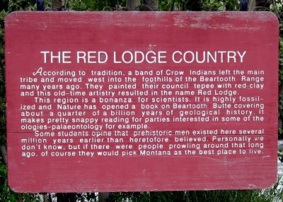
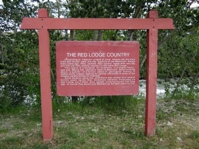
The Red Lodge Country
This region is a bonanza for scientists. It is highly fossilized and Nature has opened a book on Beartooth Butte covering about a quarter of a billion years of geological history. It makes pretty snappy reading for parties interested in some of the ologies—palaeontology for example.
Some students opine that prehistoric men exited her several million years earlier than heretofore believed. Personally we don’t know, but if there were prowling around that long ago, of course they would pick Montana as the best place to live.
Erected by Montana Highway Department.
Topics. This historical marker is listed in these topic lists: Native Americans • Science & Medicine • Settlements & Settlers.
Location. 45° 10.649′ N, 109° 14.866′ W. Marker is in Red Lodge, Montana, in Carbon County. Marker is at the intersection of South Broadway Avenue (U.S. 212) and South Hauser Avenue, on the right when traveling east on South Broadway Avenue . Located in Liver-Eating Johnston Park. Touch for map. Marker is in this post office area: Red Lodge MT 59068, United States of America. Touch for directions.
Other nearby markers. At least 8 other markers are within walking distance of this marker. Red Lodge (a few steps from this marker); The Beartooth Plateau (within shouting distance of this marker); Neithammer Brothers Meat Market (approx. half a mile away); Roman Theatre (approx. half a mile away); W.R. Hall Building (approx. half a mile away); Montana Bakery (approx. 0.6 miles away); Red Lodge Commercial District (approx. 0.6 miles away); Plunkett's Hardware (approx. 0.6 miles away). Touch for a list and map of all markers in Red Lodge.
Also see . . . Red Lodge, Montana - Gateway to Yellowstone Park. (Submitted on July 30, 2011, by Bernard Fisher of Richmond, Virginia.)
Credits. This page was last revised on June 16, 2016. It was originally submitted on July 30, 2011, by Bernard Fisher of Richmond, Virginia. This page has been viewed 705 times since then and 29 times this year. Photos: 1, 2, 3. submitted on July 30, 2011, by Bernard Fisher of Richmond, Virginia.


