Port Royal in Caroline County, Virginia — The American South (Mid-Atlantic)
Port Royal
Booth Turned Away
— John Wilkes Booth – Escape of an Assassin —
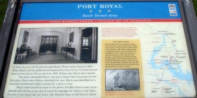
The owner, Randolph Peyton, was not at home when the group arrived. His sister, Sarah Jane Peyton, admitted the men. Booth was described as a wounded Confederate soldier looking for a place to stay.
Booth made himself at home in the parlor, but Miss Peyton soon reconsidered and told the group that it would be improper for them to stay when the man of the house was not home. She directed them to the Garrett Farm.
(Sidebar): The Garrett Farm
Richard Henry Garrett operated a modest farm about three miles south of here. Booth and company arrived there during the afternoon of April 24, 1865. While Booth settled in with the Garretts, Federal soldiers were closing fast. In the early morning hours of April 26, members of the 16th New York Cavalry cornered Booth and Herold in the Garrett tobacco barn. Herold surrendered, but Booth stayed in the barn, which was set on fire. Booth made a break for the door but was shot. He died on the Garrett house front porch. Herold was later executed.
Erected by Maryland Civil War Trails.
Topics and series. This historical marker is listed in this topic list: War, US Civil. In addition, it is included in the Booth's Escape, and the Maryland Civil War Trails series lists. A significant historical month for this entry is April 1865.
Location. 38° 10.228′ N, 77° 11.465′ W. Marker is in Port Royal, Virginia, in Caroline County. Marker is at the intersection of King Street and Caroline Street, on the left when traveling north on King Street. Touch for map. Marker is in this post office area: Port Royal VA 22535, United States of America. Touch for directions.
Other nearby markers. At least 8 other markers are within walking distance of this marker. The Fox Tavern: A Colonial Landmark (within shouting distance of this marker); The Sacred Lot (about 400 feet away, measured in a direct line); Dorothy Roy (about 500 feet away); Old Port Royal (about 600 feet away); St. Peter's Church (about 600 feet away); The Earliest Inhabitants: Native Americans (about 700 feet away); a different marker also named Port Royal (approx. 0.2 miles away); a different marker also named Port Royal (approx. 0.2 miles away). Touch for a list and map of all markers in Port Royal.
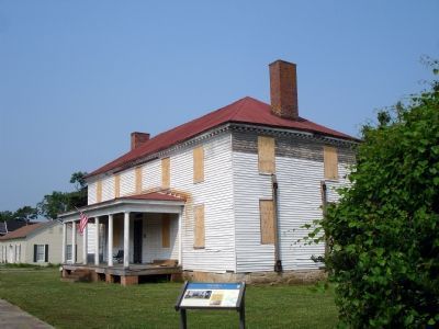
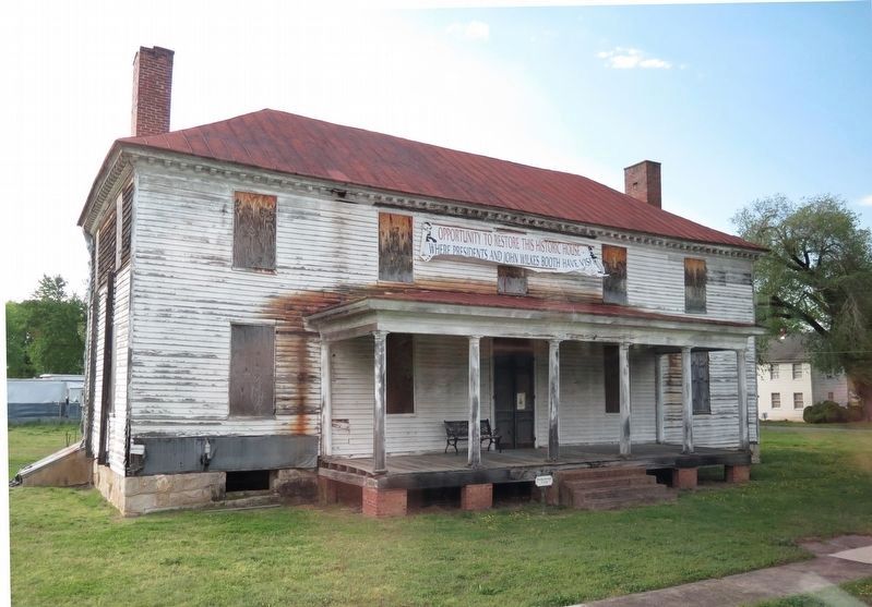
More about this marker. On the left is a photo of The Brockenbrough-Peyton House which "was built in the mid-1700s and was considered one of the finest homes in Port Royal in its day. The entry hallway, where Booth briefly relaxed, is pictured here. Its ornate woodwork was sold to the Nelson-Atkins Art Gallery in Kansas City, Mo., where it is now on display.
In the side bar is drawing showing "Booth's escape came to an end in a burning barn on the Garrett farm." On the right is a map showing Booth's escape route with stars indicating Civil War Trails sites.
While standing in Virginia, this marker is part of the Maryland Civil War Trails series.
Also see . . . Booth's Escape Byway, Maryland Office of Tourism. (Submitted on August 19, 2019.)
Additional keywords. John Wilkes Booth Escape Route
Credits. This page was last revised on October 8, 2022. It was originally submitted on January 4, 2008. This page has been viewed 5,937 times since then and 96 times this year. Last updated on October 7, 2022, by James Dean of Chesterfield, Virginia. Photos: 1, 2. submitted on January 4, 2008. 3. submitted on August 29, 2018, by Christopher J Shelton of Indianapolis, Indiana. • Bernard Fisher was the editor who published this page.


