Mammoth in Yellowstone National Park in Park County, Wyoming — The American West (Mountains)
Artist Point
Grand Canyon of the Yellowstone River
A Photographer's Canvas
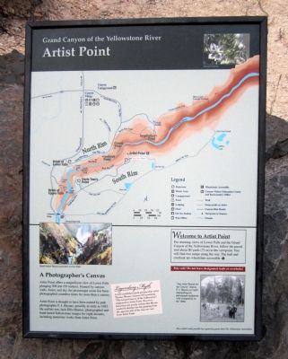
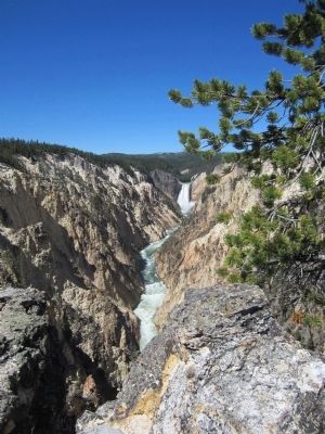
Artist Point offers a magnificent view of Lower Falls plunging 308 feet (93 meters). Framed by canyon walls, forest, and sky, the picturesque scene has been photographed countless times for more than a century.
Artist Point is thought to have been named by park photographer F.J. Haynes, possibly as early as 1883. He and his son, Jack Ellis Haynes, photographed and hand-tinted Yellowstone images for eight decades, including numerous works from Artist Point.
Welcome to Artist Point
For stunning views of Lower Falls and the Grand Canyon of the Yellowstone River, follow the paved trail about 80 yards (73 m) to the viewpoint. You will find two ramps along the way. The trail and overlook are wheelchair accessible.
Stay safe! Do not leave designated trails or overlooks!
Legendary Myth
A well-established myth persists that artist Thomas Moran's famous 1872 painting “The Grand Canyon of the Yellowstone” originated at Artist Point. However, historians are nearly certain that Moran rendered sketches for his painting from the opposite side of the canyon-not from Artist Point.
Erected by The Yellowstone Association.
Topics. This historical marker is listed in this topic list: Natural Features. A significant historical year for this entry is 1883.
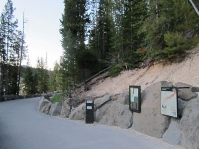
Location. 44° 43.212′ N, 110° 28.781′ W. Marker is in Yellowstone National Park, Wyoming, in Park County. It is in Mammoth. Marker can be reached from South Rim Drive, 1.6 miles east of Grand Loop Road. Touch for map. Marker is in this post office area: Yellowstone National Park WY 82190, United States of America. Touch for directions.
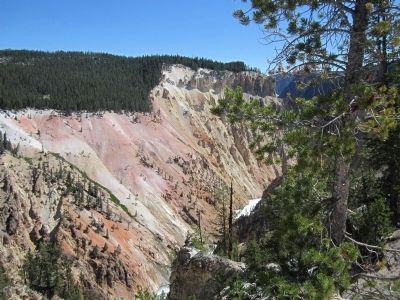
Other nearby markers. At least 8 other markers are within walking distance of this marker. Canyon Colors (about 300 feet away, measured in a direct line); The Grand Canyon of the Yellowstone (about 300 feet away); The Grand Canyon Of The Yellowstone (approx. ¼ mile away); Grand View (approx. 0.3 miles away); Lookout Point (approx. 0.4 miles away); Waterfall Makers (approx. 0.4 miles away); Inspiration Point (approx. 0.6 miles away); Shifting Ground (approx. 0.6 miles away). Touch for a list and map of all markers in Yellowstone National Park.
More about this marker. On the lower left is an image of a "Hand-tinted Haynes postcard, Lower Falls"
On the lower right is a photograph with the caption, "“Our Artist Bound for the Canyon” depicts F. J. Haynes (at right) transporting his photograph equipment with companions in the 1880s."
Also see . . . Yellowstone National Park. National Park Service (Submitted on July 30, 2011.)
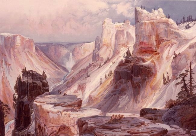
Photographed By Thomas Moran, 1872
5. The Grand Canyon, Yellowstone
This image, an 1875 chromolithograph of Moran's 1872 painting, shows the Grand Canyon and Lower Falls (not) from Artist's Point. (See marker text.)
Image courtesy of Yale Collection of Western Americana, Beinecke Rare Book and Manuscript Library
Image courtesy of Yale Collection of Western Americana, Beinecke Rare Book and Manuscript Library
Credits. This page was last revised on February 16, 2023. It was originally submitted on July 30, 2011, by Bernard Fisher of Richmond, Virginia. This page has been viewed 691 times since then and 11 times this year. Photos: 1, 2, 3, 4. submitted on July 30, 2011, by Bernard Fisher of Richmond, Virginia. 5. submitted on August 29, 2015.
