Near Boonsboro in Washington County, Maryland — The American Northeast (Mid-Atlantic)
The Battle for Fox’s Gap
“Hell is empty and all the devils are here.”
— Antietam Campaign 1862 —
Photographed By J. J. Prats
1. The Battle for Fox’s Gap Marker
Fox’s Gap Battlefield at South Mountain, Maryland
Historic America website entry:
Click for more information.
Historic America website entry:
Click for more information.
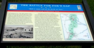
As Confederate Gen. D.H. Hill’s division struggled to hold the gaps of South Mountain on September 14, 1862, the fighting here at Fox’s Gap raged throughout the day. About 9 a.m., Gen. Jesse L. Reno’s corps attacked Confederate Gen. Samuel Garland’s lines approximately ¾ of a mile south of here and began pushing the men north towards Fox’s Gap. Sometime around midmorning, Garland fell mortally wounded and the Confederates scattered into the gap.
The fighting died down at midday as both sides delivered more men to the contest. Hill sent tow regiments of Gen. George B. Anderson's brigade to replace Garland’s scattered forces. Union Gen. Jacob D. Cox posted his regiments south of here along the edge of Daniel Wise’s field and waited for the remainder of Reno’s corps to reinforce him. As more units arrived, Hill sent Gen. Thomas F. Draytons’ and Col. George T. Anderson’s brigades along the “wood road” to attack the Federals. They formed in the Sharpsburg Road and attacked about 4 p.m.
By this time, the rest of Reno’s corps had pulled itself up onto the mountain. As Draytons’ men moved through Wise’s open field, well-aimed Union volleys struck them from behind stone walls. The Federals then counterattacked, and some Georgia troops sheltering in the sunken road soon found themselves trapped. Outnumbered four to one and suffering 51 percent casualties, Draytons’ brigade broke and fled down the mountain. Fox’s Gap was in Union hands by 5:30 p.m.
Erected by Maryland Civil War Trails.
Topics and series. This historical marker is listed in this topic list: War, US Civil. In addition, it is included in the Maryland Civil War Trails series list. A significant historical month for this entry is September 1861.
Location. 39° 28.233′ N, 77° 37.045′ W. Marker is near Boonsboro, Maryland, in Washington County. Marker is at the intersection of Reno Monument Road and the Appalachian Trail, on the left when traveling west on Reno Monument Road. Touch for map. Marker is at or near this postal address: 21605 Reno Monument Rd, Boonsboro MD 21713, United States of America. Touch for directions.
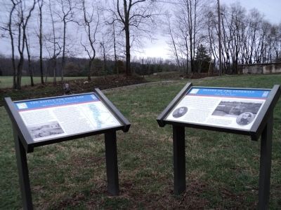
Other nearby markers. At least 5 other markers are within walking distance of this marker. Deaths of Two Generals (here, next to this marker); The Maryland Campaign of 1862 (here, next to this marker); The Lost Orders (a few steps from this marker); Welcome to Historic Wise's Field (a few steps from this marker); Near Here in Wise’s Field (a few steps from this marker). Touch for a list and map of all markers in Boonsboro.
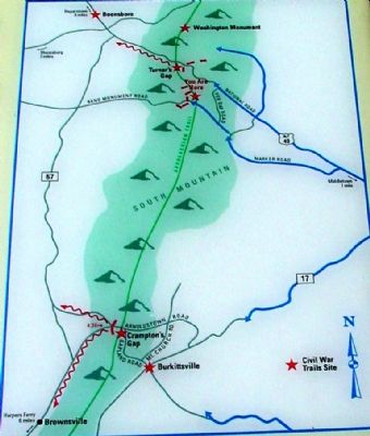
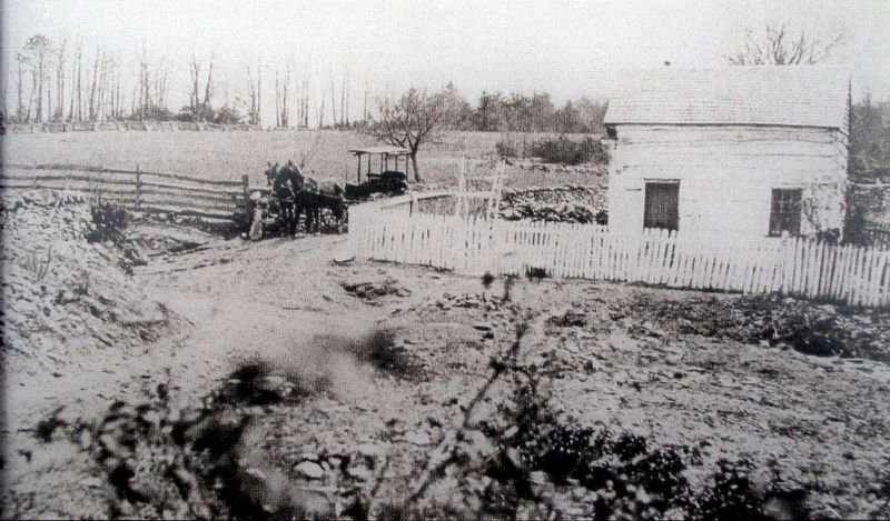
More about this marker. On the lower left a photograph is captioned, Situated on the fence-lined Old Sharpsburg Road at Fox's Gap, the Wise farm saw some of the hottest action on September 14. On the right a map of South Mountain indicates the areas involved with the battle. Other Civil War Trails sites are indicated with a red star.
Also see . . .
1. History unearthed in South Mountain. News-Post Staff article, Aug 14, 2002 (Submitted on March 26, 2022, by Larry Gertner of New York, New York.)
2. Wise Farmstead Site. Maryland Historical Trust website entry (Submitted on March 26, 2022, by Larry Gertner of New York, New York.)
Photographed By J. J. Prats, June 2, 2006
4. Five Markers Grouped Together
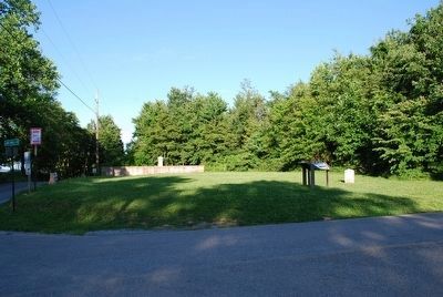
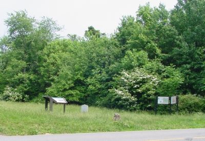
This marker is the left-most marker. The Reno monument is out-of-frame to the left. The pavement you see is the Appalachian Trail, which at this point runs on a narrow roadway used to reach the North Carolina South Mountain Monument.
Credits. This page was last revised on May 13, 2022. It was originally submitted on July 23, 2006, by J. J. Prats of Powell, Ohio. This page has been viewed 3,843 times since then and 80 times this year. Photos: 1, 2. submitted on July 23, 2006, by J. J. Prats of Powell, Ohio. 3. submitted on April 21, 2011, by Bill Coughlin of Woodland Park, New Jersey. 4. submitted on July 23, 2006, by J. J. Prats of Powell, Ohio. 5. submitted on August 9, 2015, by Brandon Fletcher of Chattanooga, Tennessee. 6. submitted on December 15, 2017, by Allen C. Browne of Silver Spring, Maryland.
