Council Grove in Morris County, Kansas — The American Midwest (Upper Plains)
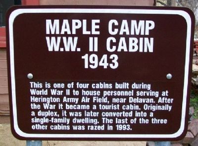
Maple Camp W.W. II Cabin
1943
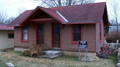
This is one of four cabins built during World War II to house personnel serving at Herington Army Air Field, near Delavan. After the War it became a tourist cabin. Originally a duplex, it was later converted into a single-family dwelling. The last of the three other cabins was razed in 1993.
Erected by Council Grove Chamber of Commerce and Tourism.
Topics. This historical marker is listed in these topic lists: Air & Space • Architecture • Industry & Commerce • War, World II. A significant historical year for this entry is 1993.
Location. 38° 39.489′ N, 96° 29.938′ W. Marker is in Council Grove, Kansas, in Morris County. Marker is on Adams Street near Main Street (U.S. 56), on the right when traveling south. Marker and cabin are on the grounds of the Terwilliger House, 803 West Main Street. Touch for map. Marker is in this post office area: Council Grove KS 66846, United States of America. Touch for directions.
Other nearby markers. At least 8 other markers are within walking distance of this marker. Maple Camp Tourist Cabin (a few steps from this marker); Field School (a few steps from this marker); a different marker also named Maple Camp Tourist Cabin (within shouting distance of this marker); Baker's Food Market (within shouting distance of this marker); Atkinson Log House (within shouting distance of this marker); Maple Camp (within shouting distance of this marker); Terwilliger Home / Trail Days House (within shouting distance of this marker); Greenwood Cemetery Wall (about 600 feet away, measured in a direct line). Touch for a list and map of all markers in Council Grove.
Also see . . .
1. Herington Army Air Field. Wikipedia entry (Submitted on January 25, 2022, by Larry Gertner of New York, New York.)
2. Herington Regional Airport. City website entry (Submitted on August 1, 2011, by William Fischer, Jr. of Scranton, Pennsylvania.)
3. History of Herington, Kansas. City website entry (Submitted on August 1, 2011, by William Fischer, Jr. of Scranton, Pennsylvania.)
Credits. This page was last revised on January 25, 2022. It was originally submitted on August 1, 2011, by William Fischer, Jr. of Scranton, Pennsylvania. This page has been viewed 427 times since then and 19 times this year. Photos: 1, 2. submitted on August 1, 2011, by William Fischer, Jr. of Scranton, Pennsylvania.

