Near Pence in Iron County, Wisconsin — The American Midwest (Great Lakes)
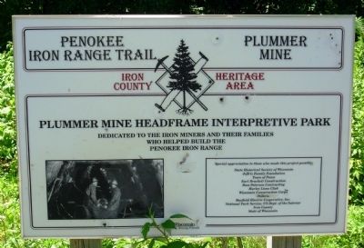
Penokee Iron Range Trail - Plummer Mine
Iron County Heritage Area
Topics. This historical marker is listed in this topic list: Industry & Commerce.
Location. 46° 24.469′ N, 90° 17.586′ W. Marker is near Pence, Wisconsin, in Iron County. Marker can be reached from Plummer Road, ¼ mile south of Wisconsin Highway 77. Marker is located in Plummer Mine Headframe Interpretive Park. Touch for map. Marker is in this post office area: Montreal WI 54550, United States of America. Touch for directions.
Other nearby markers. At least 8 other markers are within 4 miles of this marker, measured as the crow flies. Penokee Iron Range Trail - Plummer Location (a few steps from this marker); Penokee Iron Range Trail - Plummer Mine Geologic Layer Cake (a few steps from this marker); Flambeau Trail – Flambeau Trail Crossing (approx. 2.2 miles away); Penokee Iron Range Trail – A Company Town (approx. 3 miles away); Penokee Iron Range Trail – Montreal Location (approx. 3 miles away); George W. Sullivan (approx. 3.4 miles away); The City of Montreal (approx. 3.4 miles away); Penokee Iron Range Trail – Gile Falls (approx. 3.6 miles away). Touch for a list and map of all markers in Pence.
Additional keywords. Mining

Photographed By Paul Fehrenbach, July 21, 2011
3. Penokee Iron Range Trail - Plummer Mine Marker
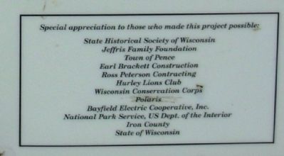
(Inset) Special appreciation to those who made this project possible: State Historical Society of Wisconsin, Jeffris Family Foundation, Town of Pence, Earl Brackett Construction, Ross Peterson Contracting, Hurley Lions Club, Wisconsin Conservation Corps, Polaris, Bayfield Electric Cooperative, Inc., National Park Service, US Dept. of the Interior, Iron County, State of Wisconsin
Credits. This page was last revised on November 25, 2020. It was originally submitted on July 28, 2011, by Paul Fehrenbach of Germantown, Wisconsin. This page has been viewed 767 times since then and 40 times this year. Last updated on August 2, 2011, by Paul Fehrenbach of Germantown, Wisconsin. Photos: 1, 2, 3, 4. submitted on July 28, 2011, by Paul Fehrenbach of Germantown, Wisconsin. • Bill Pfingsten was the editor who published this page.


