Near Placitas in Sandoval County, New Mexico — The American Mountains (Southwest)
Las Placitas
English:
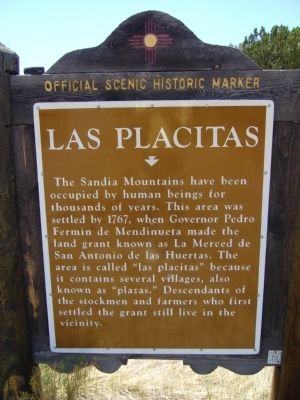
The Sandia Mountains have been occupied by human beings for thousands of years. This area was settled by 1767, when Governor Pedro Fermin de Mendinueta made the land grant known as La Merced de San Antonio de las Huertas. The area is called “las placitas” because it contains several villages, also known as “plazas.” Descendants of the stockmen and farmers who first settled the grant still live in the vicinity.
Spanish:
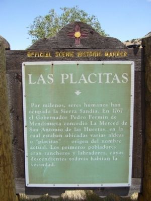
Por milenos, seres humanos han ocupado la Sierra Sandia. En 1767 el Gobernador Pedro Fermin de Mendinueta concedio La Merced de San Antonio de las Huertas, en la cual estaban ubicadas varias aldeas o "placitas" -- origen del nombre actual. Los primeros pobladores eran rancheros y labradores, cuyos descendientes todavia habitan la vecindad.
Erected by New Mexico Historic Preservation Division.
Topics. This historical marker is listed in this topic list: Settlements & Settlers. A significant historical year for this entry is 1767.
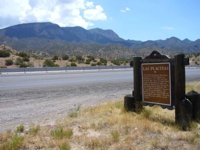
Location. 35° 18.069′ N, 106° 28.308′ W. Marker is near Placitas, New Mexico, in Sandoval County. Marker is on State Road 165 at milepost 3.6 west of Vista de Oro, on the left when traveling east. Touch for map. Marker is in this post office area: Placitas NM 87043, United States of America. Touch for directions.
Other nearby markers. At least 8 other markers are within 8 miles of this marker, measured as the crow flies. Women Veterans of New Mexico (approx. 3.4 miles away); Vietnam War Memorial (approx. 4.3 miles away); Bernalillo (approx. 4.6 miles away); La Angostura (approx. 5.2 miles away); Spanish Entrada Site (approx. 6½ miles away); Doña Dolores “Lola” Chávez de Armijo (approx. 7.4 miles away); a different marker also named Bernalillo (approx. 7.6 miles away); Wild at Heart (approx. 7.6 miles away).
Credits. This page was last revised on June 16, 2016. It was originally submitted on August 2, 2011, by Bill Kirchner of Tucson, Arizona. This page has been viewed 1,218 times since then and 81 times this year. Photos: 1, 2, 3. submitted on August 2, 2011, by Bill Kirchner of Tucson, Arizona. • Bernard Fisher was the editor who published this page.


