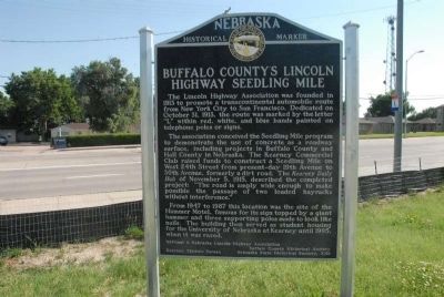
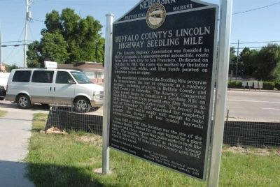
Buffalo County’s Lincoln Highway Seedling Mile
The association conceived the Seedling Mile program to demonstrate the use of concrete as a roadway surface, including projects in Buffalo County and Hall County in Nebraska. The Kearney Commercial Club raised funds to construct a Seedling Mile on West 24th Street from present-day 19th Avenue to 30th Avenue, formerly a dirt road. The Kearney Daily Hub of November 5, 1915, described the completed project: “The road is amply wide enough to make possible the passage of two loaded hayracks without interference.”
From 1947 to 1987 this location was the site of the Hammer Motel, famous for its sign topped by a giant hammer and three supporting poles made to look like nails. The building then served as student housing for the University of Nebraska at Kearney until 1995, when it was razed.
Erected 2010 by National & Nebraska Lincoln Highway Association,Buffalo County Historical Society, Kearney Visitor Bureau, Nebraska State Historical Society. (Marker Number 488.)
Topics and series. This
Location. 40° 41.97′ N, 99° 6.298′ W. Marker is in Kearney, Nebraska, in Buffalo County. Marker is on U.S. 30, on the right when traveling west. Touch for map. Marker is in this post office area: Kearney NE 68849, United States of America. Touch for directions.
Other nearby markers. At least 8 other markers are within 2 miles of this marker, measured as the crow flies. The Frank House (approx. 0.2 miles away); Hostetler Amphitheatre (approx. 0.4 miles away); Kearney State College Memorial Carillon Tower (approx. half a mile away); University of Nebraska at Kearney (approx. 0.6 miles away); Baldwin Engine 481 (approx. 1.2 miles away); Shelton Union Pacific Depot (approx. 1.2 miles away); Loup River Freighter Hotel (approx. 1.2 miles away); Kearney Civil War and Spanish-American War Memorial (approx. 1.2 miles away). Touch for a list and map of all markers in Kearney.
Also see . . .
1. Looking Back on the History of the Hammer Motel.
It’s parking lot number 27 at Highway 30 and West 19th Avenue on the University of Nebraska at Kearney campus. But 60 years ago, it was the location of Hammer Motel, a popular overnight stop for travelers along the Lincoln Highway. The
2. Seedling mile at west edge of Kearney, Nebraska.
1926 Photo of the Lincoln Highway seedling mile at the west edge of Kearney, Nebraska (Submitted on March 9, 2017, by Cosmos Mariner of Cape Canaveral, Florida.)
Credits. This page was last revised on March 31, 2017. It was originally submitted on August 4, 2011, by Charles T. Harrell of Woodford, Virginia. This page has been viewed 1,081 times since then and 23 times this year. Photos: 1, 2. submitted on August 4, 2011, by Charles T. Harrell of Woodford, Virginia. • Bill Pfingsten was the editor who published this page.

