East Portal in Mineral County, Montana — The American West (Mountains)
The Trail Follows the Trains
…and Historians Trace the History along the Trail.
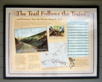
When the Milwaukee Road abandoned its route over the Bitterroot Mountains, salvage companies stripped the line of all the rails, ties, signals, posts and everything else of value. The small fragments left behind are the remains of one of America’s proudest railroads.
From 1907 to 1911 thousands of people lived, worked and played in this secluded part of the Bitterroot Mountains. They constructed a railroad while leaving faint signs of their own passing.
Today, you may see archaeologists digging and sifting along the Route of the Hiawatha looking for clues about people and places not found in written documents.
Historical research and archaeological field work helps breathe lire into the history of the Milwaukee Road years.
(sidebar)
Artifacts tell a story if they are found in the context in which were used. It is illegal to remove or destroy artifacts from the Route of the Hiawatha Trail. This preserves the history of the Milwaukee Road for everyone to enjoy.
Topics. This historical marker is listed in this topic list: Railroads & Streetcars. A significant historical year for this entry is 1907.
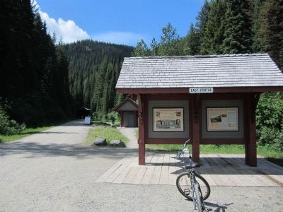
Location. 47° 23.785′ N, 115° 38.13′ W. Marker is in East Portal, Montana, in Mineral County. Marker can be reached from Rainy Creek Road (Federal Road 506) near Exit 5 (Taft) (Interstate 90). Located at the Route of the Hiawatha Trailhead. Touch for map. Marker is in this post office area: Saltese MT 59867, United States of America. Touch for directions.
Other nearby markers. At least 8 other markers are within walking distance of this marker. The Route of the Hiawatha (here, next to this marker); St. Paul Pass Tunnel (here, next to this marker); The Wickedest City (a few steps from this marker); An Unlikely Safe Haven (within shouting distance of this marker); Douse the Flames and Climb Aboard (within shouting distance of this marker); Building From the Ashes (within shouting distance of this marker); When the Mountains Roared (within shouting distance of this marker); A Battle That Could Not Be Won (within shouting distance of this marker). Touch for a list and map of all markers in East Portal.
More about this marker. On the left is a photo with the caption, "This early hand colored Milwaukee Road photo shows a train coming from Avery towards the crest of the Bitterroots. It would soon be crossing Barnes Creek trestle on the upper right. The tunnel 23 portal ca be seen in the center distance."
On the upper right is a photo with the caption, "Forest Service “Passport in Time” program volunteers Glen Selman and Paul Wilson excavate one of the historic sites along the trail." USDA Forest Service photograph
On the lower right is a map with the caption, "The Route of the Hiawatha is listed on the National Register of Historic Places because of its association with historic events such as the 1910 fires and because it still contains information important to the history of the Northwest."
Also see . . . Route of the Hiawatha Rail Trail. (Submitted on August 4, 2011, by Bernard Fisher of Richmond, Virginia.)
Credits. This page was last revised on June 16, 2016. It was originally submitted on August 4, 2011, by Bernard Fisher of Richmond, Virginia. This page has been viewed 590 times since then and 9 times this year. Photos: 1, 2. submitted on August 4, 2011, by Bernard Fisher of Richmond, Virginia.

