East Portal in Mineral County, Montana — The American West (Mountains)
The Wickedest City
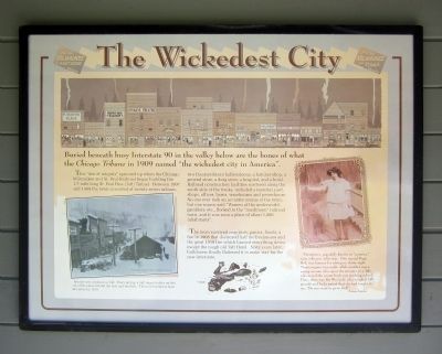
Buried beneath busy Interstate 90 in the valley below are the bones of what the Chicago Tribune in 1909 named “the wickedest city in America”.
This “den of iniquity” sprouted up when the Chicago, Milwaukee and St. Paul Railroad began building the 1.7-mile long St. Paul Pass (Taft) Tunnel. Between 1907 and 1909 the town consisted of twenty-seven saloons, two theaters/dance halls/saloons, a butcher shop, a general store, a drug store, a hospital, and a hotel. Railroad construction facilities scattered along the south side of the tracks, included a material yard, shops, offices, barns, warehouses and powerhouse. No one ever took an accurate census of the town, but one source said “Women of the underworld, gamblers, etc., flocked to the “mushroom” railroad town, and it was soon a place of about 1,000 inhabitants”.
The town survived near riots, panics, floods, a fire in 1908 that destroyed half the businesses and the great 1910 fire which burned everything down except the tough old Taft Hotel. Sixty years later, bulldozers finally flattened it to make way for the new interstate.
(sidebar)
“Prostitutes, popularly known as “canaries,” were a diverse collection. One named Dago Red, was famous for taking on thirty-eight Montenegrans one night, while another was a young woman who spent the summer in a Taft salon and the winter back east teaching school. Then, there was Pee Wee Jack, who weighed 250 pounds and had a parrot that she had taught to say, “Do you want to go to bed?” Montana Magazine
Topics. This historical marker is listed in these topic lists: Entertainment • Railroads & Streetcars • Women. A significant historical year for this entry is 1909.
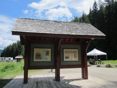
Location. 47° 23.78′ N, 115° 38.126′ W. Marker is in East Portal, Montana, in Mineral County. Marker can be reached from Rainy Creek Road (Federal Road 506) 2 miles south of Exit 5 (Taft) (Interstate 90). Located at the Route of the Hiawatha Trailhead. Touch for map. Marker is in this post office area: Saltese MT 59867, United States of America. Touch for directions.
Other nearby markers. At least 8 other markers are within walking distance of this marker. The Route of the Hiawatha (here, next to this marker); St. Paul Pass Tunnel (a few steps from this marker); The Trail Follows the Trains (a few steps from this marker); Douse the Flames and Climb Aboard (within shouting distance of this marker); An Unlikely Safe Haven (within shouting distance of this marker); Building From the Ashes (within shouting distance of this marker); When the Mountains Roared (within shouting distance of this marker); A Battle That Could Not Be Won (within shouting distance of this marker). Touch for a list and map of all markers in East Portal.
More about this marker. On the lower left is a photo with the caption, "Murder was common in Taft. Every spring, half a dozen bodies melted out of the snow behind the bars and brothels. This toll reached at least 44 bodies by 1910. Photograph courtesy Montana Historical Society
Also see . . . Route of the Hiawatha Rail Trail. (Submitted on August 4, 2011, by Bernard Fisher of Richmond, Virginia.)
Additional keywords. prostitution
Credits. This page was last revised on April 16, 2018. It was originally submitted on August 4, 2011, by Bernard Fisher of Richmond, Virginia. This page has been viewed 836 times since then and 16 times this year. Photos: 1, 2. submitted on August 4, 2011, by Bernard Fisher of Richmond, Virginia.

