Capon Bridge in Hampshire County, West Virginia — The American South (Appalachia)
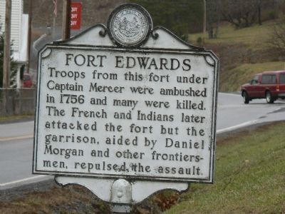
Fort Edwards
Inscription.
Troops from this fort under Captain Mercer were ambushed in 1756 and many were killed. The French and Indians later attacked the fort but the garrison, aided by Daniel Morgan and other frontiersmen, repulsed the assault.
Erected by State of West Virginia.
Topics and series. This historical marker is listed in these topic lists: Forts and Castles • Heroes • War, French and Indian. In addition, it is included in the West Virginia Archives and History series list. A significant historical year for this entry is 1756.
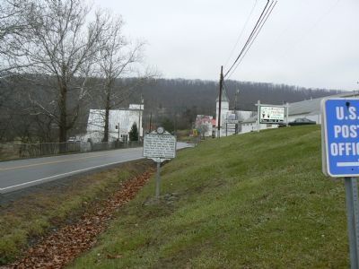
Location. 39° 17.894′ N, 78° 26.172′ W. Marker is in Capon Bridge, West Virginia, in Hampshire County. Marker is on U.S. 50, on the right when traveling west. Marker is about 100 yards west of bridge over Cacapon River. Touch for map. Marker is in this post office area: Capon Bridge WV 26711, United States of America. Touch for directions.
Other nearby markers. At least 8 other markers are within walking distance of this marker. Northwestern Turnpike (approx. 0.2 miles away); Edward's Fort Stockade Replica (approx. 0.3 miles away); The Ken Edmonds Memorial Heritage Trail (approx. 0.4 miles away); Soldiers and Settlers (approx. 0.4 miles away); Forts in Col. George Washington's Chain of Forts Guarding the Eighteenth Century Virginia Froniter (approx. 0.4 miles away); The Fort Comes and Goes (approx. 0.4 miles away); Some French and Indian War Incidents in Hampshire County (approx. 0.4 miles away); Gen. Braddock is Defeated (approx. 0.4 miles away). Touch for a list and map of all markers in Capon Bridge.
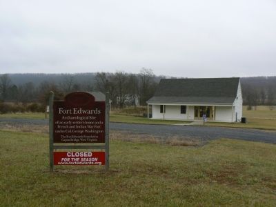
Regarding Fort Edwards. Fort Edwards was one of a string of forts on the western frontier commanded by Col. George Washington during the French and Indian War. For a detailed history, see the link to the Fort Edwards Foundation below. The site of the fort itself is about a half mile from the marker. To get there, take the next right (going west) after the marker. The site, managed by the Fort Edwards Foundation, is on the right.
Also see . . . Fort Edwards Foundation. A Colonial Settler's Home and a French and Indian War Fort on the Virginia Frontier (Submitted on January 5, 2008, by Craig Swain of Leesburg, Virginia.)
Additional keywords. Daniel Morgan, George Washington
Credits. This page was last revised on May 29, 2020. It was originally submitted on January 5, 2008, by Franklin Bell of Bluemont, Virginia. This page has been viewed 2,829 times since then and 25 times this year. Last updated on January 6, 2008, by Franklin Bell of Bluemont, Virginia. Photos: 1, 2, 3. submitted on January 5, 2008, by Franklin Bell of Bluemont, Virginia. • Craig Swain was the editor who published this page.


