Near Avery in Shoshone County, Idaho — The American West (Mountains)
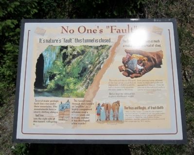
No One’s “Fault”
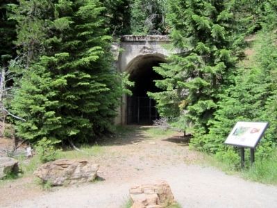
It's nature’s “fault” this tunnel is closed…
Several major geologic fault lines run under these mountains. The mountainside here is slowly shifting along a fault line into the right side of this tunnel, collapsing it.
The tunnel runs through rock known as “argillite”, a highly compressed siltstone over a billion years old. Is it any wonder it has developed a few cracks?
(sidebar)
The Milwaukee Road was a much a road of stone as a road of steel.
The rails and ties on this part of the line sat on a rock bed of distinctive, colorful quartzite ballast mined from quarries 85 miles away in Montana.
Ballast kept the railroad ties in place, distributed weight from passing trains, allowed water to drain and protected against frost heaves. Over 80 percent of the rail-trail surface you're on is reused ballast.
(sidebar)
The Yeas and Neighs…of Track Width
Some say ancient, Imperial Romans originated the 4 foot, 8½ inch “Standard Gauge” spacing for wagon wheels by designing their war chariots and carts to uniformly fit behind the behinds of two Roman warhorses. And that centuries later railroads inherited this unique spacing. Well, maybe…
Topics. This historical marker is listed in this topic list: Railroads & Streetcars.
Location. 47° 21.159′ N, 115° 38.501′ W. Marker is near Avery, Idaho, in Shoshone County. Marker can be reached from Cliff Creek Road (Federal Road 506) 1.8 miles north of Loop Creek Road (Federal Road 326). Located along the Route of the Hiawatha Trail. Touch for map. Marker is in this post office area: Avery ID 83802, United States of America. Touch for directions.
Other nearby markers. At least 8 other markers are within walking distance of this marker. Bridging the Gaps (approx. 0.2 miles away); Section Gangs (approx. ¼ mile away); Little in Name Only (approx. 0.4 miles away); The 1910 Fires (approx. half a mile away); The Big Blowup (approx. 0.7 miles away); The Olympian Hiawatha (approx. 0.8 miles away); Tunneling Toward Tacoma (approx. 0.8 miles away); Temporary Trestles (approx. 0.8 miles away). Touch for a list and map of all markers in Avery.
Also see . . . Route of the Hiawatha Rail Trail. (Submitted on August 4, 2011, by Bernard Fisher of Richmond, Virginia.)
Credits. This page was last revised on June 16, 2016. It was originally submitted on August 4, 2011, by Bernard Fisher of Richmond, Virginia. This page has been viewed 588 times since then and 9 times this year. Photos: 1, 2. submitted on August 4, 2011, by Bernard Fisher of Richmond, Virginia.

