Near Avery in Shoshone County, Idaho — The American West (Mountains)
Rough Roads & Wrecks
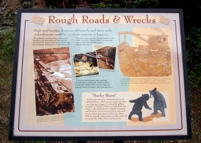
High steel trestles, long curved tunnels and steep rocky embankments could be accidents waiting to happen…
But diligent, hard-working Milwaukee Roaders saw that relatively few wrecks shattered the quiet beauty of the Bitterroots. Occasionally destructive wrecks did occur.
Two steam locomotives collided head on in 1910. In 1919, “Motor Creek” got its name when a Box Cab electric engine derailed beside it.
Derailments became distressingly commonplace along the whole system during the 1970s as the dying company put less and less money into maintenance.
(sidebar)
"Barley Bears"
Imagine encountering a boisterous group of inebriated bears. That was not uncommon after some large grain hopper cars derailed, spilling hundreds of bushels of wheat over the banks near Falcon. The ruined grain eventually fermented and the bears, always in search of an easy meal, ate the intoxicating grain and became either a little too friendly when drunk or really cranky the morning after with a “bear” of a hangover.
Topics. This historical marker is listed in this topic list: Railroads & Streetcars. A significant historical year for this entry is 1910.
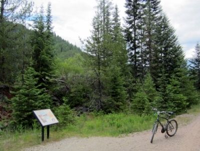
Location. 47° 21.331′ N, 115° 43.548′ W. Marker is near Avery, Idaho, in Shoshone County. Marker can be reached from Moon Pass Road (Federal Road 456) 0.4 miles south of Loop Creek Road (Federal Road 326). Located along the Route of the Hiawatha Trail. Touch for map. Marker is in this post office area: Avery ID 83802, United States of America. Touch for directions.
Other nearby markers. At least 8 other markers are within walking distance of this marker. Bumps on the Milwaukee Road (approx. 0.2 miles away); Laboring in Luxury (approx. 0.4 miles away); You want to be a Ranger? (approx. 0.6 miles away); Not So "Lucky" Swedes (approx. 0.6 miles away); The Route of the Hiawatha (approx. 0.6 miles away); Busy Bogle Spur (approx. 0.6 miles away); The End of the Road? (approx. 0.6 miles away); Railroad at WAR! (approx. one mile away). Touch for a list and map of all markers in Avery.
More about this marker. On the lower left is a photo with the caption, "This heavy Quill locomotive pulling the “Columbian” passenger train derailed and fell into the North Fork of the St. Joe River just above Avery in 1933." Photograph courtesy Rick Marshall
In the center are photos of area derailments. Photographs courtesy Darrel Dewald
On the upper right is a sketch with the caption, "It took Big Brutes to clean up Big Messes! Rushed to wreck sites by ever-ready maintenance trains, gigantic cranes could wrench derailed cars and heavy locomotives weighing up to 250 tons back on track."
Also see . . . Route of the Hiawatha Rail Trail. (Submitted on August 5, 2011, by Bernard Fisher of Richmond, Virginia.)
Credits. This page was last revised on June 16, 2016. It was originally submitted on August 5, 2011, by Bernard Fisher of Richmond, Virginia. This page has been viewed 606 times since then and 6 times this year. Photos: 1, 2. submitted on August 5, 2011, by Bernard Fisher of Richmond, Virginia.

