Near Avery in Shoshone County, Idaho — The American West (Mountains)
Bumps on the Milwaukee Road
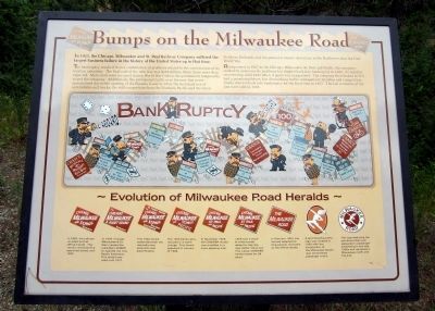
In 1925, the Chicago, Milwaukee and St. Paul Railway Company suffered the largest business failure in the history of the United States up to that time.
The bankruptcy resulted from a combination of problems related to the construction of its western extension. The final cost of the new line was $257 million, three times more than expected. More costs were incurred during World War I when the government temporarily seized the company. Additionally, the anticipated traffic over the new line never materialized due to the opening of the Panama Canal in 1914, the increased use of automobiles and trucks, the stiff competition from the Northern Pacific and the Great Northern Railroads and the general economic turndown in the Northwest after the First World War.
Reorganized in 1927 as the Chicago, Milwaukee, St. Paul and Pacific, the company worked to overcome its problems but slipped back into bankruptcy in 1935. It stayed in receivership until 1945 when it again was reorganized. The company then looked as if it had a promising future, but diminishing traffic, management mistakes and competition finally drove it back into bankruptcy for the final time in 1977. The last remnants of the line were sold in 1985.
(sidebar)
Evolution of Milwaukee Road Heralds
In 1885, the railroad unveiled its first official herald. This version remained the approved herald until 1922.
In 1909, Chicago, Milwaukee & St. Paul created the subsidiary CM&PS to operate the new Pacific Extension. This herald was used until 1912.
This 1922 celebrated both the railroad’s new extension and electrification.
The 1925 bankruptcy resulted in a name change. This herald appeared in January of 1928.
In November 1928, the CMStP&P herald was modified more pleasing look.
1929 saw a black & white border added to help the logo better stand out. This classic CMStP&P herald lasted for 24 years.
In February 1953, the railroad adopted its long-popular nickname as the official herald.
A sprinting Hiawatha logo was created in 1935 with the introduction of the Milwaukee Road’s new streamlined passenger trains.
This logo featuring the sprinting Indian Icon appeared in passenger advertising in the late 1950s and remained a Milwaukee motif until the end.
Topics. This historical marker is listed in these topic lists: Industry & Commerce • Railroads & Streetcars. A significant historical month for this entry is January 1928.
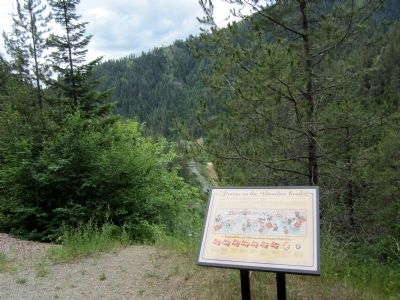
Location. 47° 21.259′ N, 115° 43.767′ W. Marker is near Avery, Idaho, in Shoshone County. Marker can be reached from Moon Pass Road (Federal Road 456) 0.4 miles south of Loop Creek Road (Federal Road 326). Located along the Route of the Hiawatha Trail. Touch for map. Marker is in this post office area: Avery ID 83802, United States of America. Touch for directions.
Other nearby markers. At least 8 other markers are within 2 miles of this marker, measured as the crow flies. Rough Roads & Wrecks (approx. 0.2 miles away); Not So "Lucky" Swedes (approx. 0.4 miles away); The Route of the Hiawatha (approx. 0.4 miles away); Busy Bogle Spur (approx. 0.4 miles away); The End of the Road? (approx. 0.4 miles away); Laboring in Luxury (approx. 0.6 miles away); You want to be a Ranger? (approx. ¾ mile away); Railroad at WAR! (approx. 1.2 miles away). Touch for a list and map of all markers in Avery.
Also see . . . Route of the Hiawatha Rail Trail. (Submitted on August 5, 2011, by Bernard Fisher of Richmond, Virginia.)
Credits. This page was last revised on June 16, 2016. It was originally submitted on August 5, 2011, by Bernard Fisher of Richmond, Virginia. This page has been viewed 789 times since then and 6 times this year. Photos: 1, 2. submitted on August 5, 2011, by Bernard Fisher of Richmond, Virginia.

