Seven Mile Ford in Smyth County, Virginia — The American South (Mid-Atlantic)
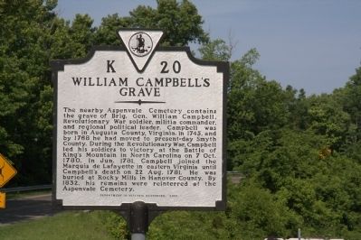
William Campbell’s Grave
The nearby Aspenvale Cemetery contains the grave of Brig. Gen. William Campbell, Revolutionary War soldier, militia commander, and regional political leader. Campbell was born in Augusta County, Virginia. in 1745, and by 1768 he had moved to present-day Smyth County. During the Revolutionary War, Campbell led his soldiers to victory at the Battle of King’s Mountain in North Carolina on 7 Oct. 1780. In Jun. 1781, Campbell joined the Marquis de Lafayette in eastern Virginia until Campbell’s death on 22 Aug. 1781. He was buried at Rocky Mills in Hanover County. By 1832, his remains were reinterred at the Aspenvale Cemetery.
Erected 2000 by Department of Historic Resources. (Marker Number K-20.)
Topics and series. This historical marker is listed in this topic list: War, US Revolutionary. In addition, it is included in the Virginia Department of Historic Resources (DHR) series list. A significant historical month for this entry is June 1781.
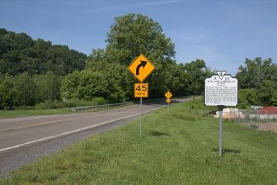
Location. 36° 48.638′ N, 81° 38.512′ W. Marker is in Seven Mile Ford, Virginia, in Smyth County. Marker is at the intersection of Lee Highway (U.S. 11) and Wadill Lane, on the right when traveling west on Lee Highway. Touch for map. Marker is in this post office area: Marion VA 24354, United States of America. Touch for directions.
Other nearby markers. At least 8 other markers are within 3 miles of this marker , measured as the crow flies. Campbell's Home (approx. 0.2 miles away); Seven Mile Ford (approx. 0.9 miles away); Chilhowie Methodist Episcopal Church (approx. 2.3 miles away); Transportation Through the Ages (approx. 2.4 miles away); Chilhowie (approx. 2.4 miles away); a different marker also named Chilhowie (approx. 2½ miles away); Farthest West, 1750 (approx. 2½ miles away); Town House (approx. 2½ miles away).
More about this marker. This marker replaced a 1930s marker with the same name and number that read, “A short distance north are the home site and grave of William Campbell, noted Indian fighter and commander of troops at the Battle of King’s Mountain, 1780. Later he was with Lafayette in eastern Virginia until his death, August 22, 1781, shortly before the siege of Yorktown.”
Also see . . . General William Campbell. Wikipedia entry
“William Campbell (1745–1781) was a Virginia farmer, pioneer, and soldier. One of the thirteen signers of the earliest statement of armed resistance to the British Crown in the American Colonies, the Fincastle Resolutions, Campbell represented Hanover County in the Virginia House of Delegates. A militia leader during the American Revolutionary War, he was known as the ‘bloody tyrant of Washington County’ for his treatment of Loyalists. He is known for his leadership at the Battle of Kings Mountain and the Battle of Guilford Courthouse.” (Submitted on August 6, 2011.)

Internet Archive
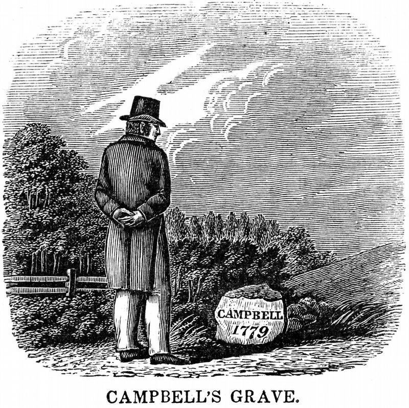
3. Campbell's Grave
from Historical, Poetical and Pictorial American Scenes, by John Warner Barber and Elizabeth G. Barber, 1851.
“The spot is still to be seen, designated by a small rough stone, on which is inscribed ‘Campbell, 1779,’ erected by the Author of this work, in Sept. 1844.” -- John Warner Barber.
“The spot is still to be seen, designated by a small rough stone, on which is inscribed ‘Campbell, 1779,’ erected by the Author of this work, in Sept. 1844.” -- John Warner Barber.
Credits. This page was last revised on December 7, 2022. It was originally submitted on August 6, 2011, by J. J. Prats of Powell, Ohio. This page has been viewed 1,097 times since then and 47 times this year. Last updated on March 1, 2019, by Allen C. Browne of Silver Spring, Maryland. Photos: 1, 2. submitted on August 6, 2011, by J. J. Prats of Powell, Ohio. 3. submitted on February 17, 2019, by Allen C. Browne of Silver Spring, Maryland. • Bill Pfingsten was the editor who published this page.

