Marker Logo HMdb.org THE HISTORICAL
MARKER DATABASE
“Bite-Size Bits of Local, National, and Global History”
Vernon in Jennings County, Indiana — The American Midwest (Great Lakes)
 

New Survey Markers Set


New Survey Markers Set Marker image. Click for full size.
Photographed By Courtesy:: Marilyn S. Wolf, August 7, 2011
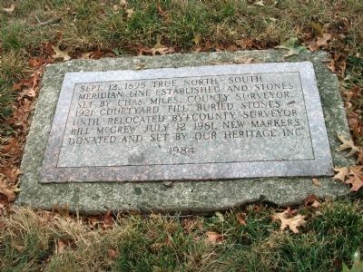
1. New Survey Markers Set Marker
Inscription. Sept. 12, 1895 True North-South Meridian line established and stones set by Chas. Miles, County Surveyor. 1921 Courtyard fill buried stones until relocated by County Surveyor Bill McGrew July 12, 1981. New Markers donated and set by Our Heritage Inc. 1984
 
Topics. This historical marker is listed in this topic list: Notable Events. A significant historical date for this entry is July 12, 1818.
 
Location. 38° 59.083′ N, 85° 36.537′ W. Marker is in Vernon, Indiana, in Jennings County. Marker is on Jackson Street (State Road 7) east of North Pike Street, on the left when traveling east. Located on the South lawn of the Jennings County Courthouse in Vernon, Indiana. Touch for map. Marker is in this post office area: Vernon IN 47282, United States of America. Touch for directions.
 
Other nearby markers. At least 8 other markers are within walking distance of this marker. Morgan's Raid (here, next to this marker); Vernon Historic District (a few steps from this marker); Jonathan Jennings (within shouting distance of this marker); a different marker also named Morgan's Raid (within shouting distance of this marker); Morgan is Forced to Turn Back, (approx. 0.4 miles away); Jennings County Veterans Memorial (approx. 0.4 miles away); Muscatatuck Park (approx. 0.6 miles away); Walnut Grove One-room School 1913 (approx. 0.6 miles away). Touch for a list and map of all markers in Vernon.
 
Paid Advertisement
Click on the ad for more information.
Please report objectionable advertising to the Editor.
Click or scan to see
this page online
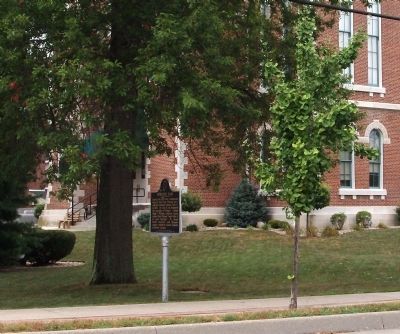
Wide View - - New Survey Markers Set Marker image. Click for full size.
Photographed By Courtesy:: Marilyn S. Wolf, August 7, 2011
2. Wide View - - New Survey Markers Set Marker
Marker can be seen to the right (and slightly behind) of another historic marker.
East Side - - Jennings County Courthouse - Vernon, Indiana image. Click for full size.
Photographed By Courtesy:: Marilyn S. Wolf, August 7, 2011
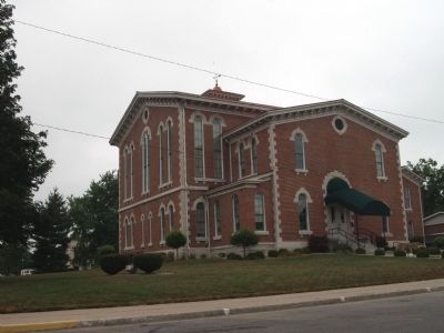
3. East Side - - Jennings County Courthouse - Vernon, Indiana
West Side - - Jennings County Courthouse - Vernon, Indiana image. Click for full size.
Photographed By Courtesy:: Marilyn S. Wolf, August 7, 2011
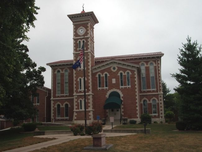
4. West Side - - Jennings County Courthouse - Vernon, Indiana
Community Time Capsule - - (On West Lawn of Courthouse.) image. Click for full size.
Photographed By Courtesy:: Marilyn S. Wolf, August 7, 2011
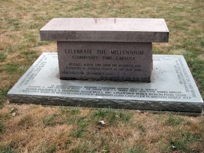
5. Community Time Capsule - - (On West Lawn of Courthouse.)
 
 
Credits. This page was last revised on January 8, 2021. It was originally submitted on August 8, 2011, by Al Wolf of Veedersburg, Indiana. This page has been viewed 473 times since then and 10 times this year. Photos:   1, 2, 3, 4, 5. submitted on August 8, 2011, by Al Wolf of Veedersburg, Indiana. • Bill Pfingsten was the editor who published this page.
Share this page.  
Share on Tumblr
m=45811

CeraNet Cloud Computing sponsors the Historical Marker Database.
This website earns income from purchases you make after using our links to Amazon.com. We appreciate your support.
Paid Advertisement
Apr. 16, 2024