Near Britton's Neck in Marion County, South Carolina — The American South (South Atlantic)
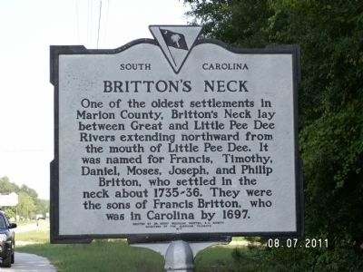
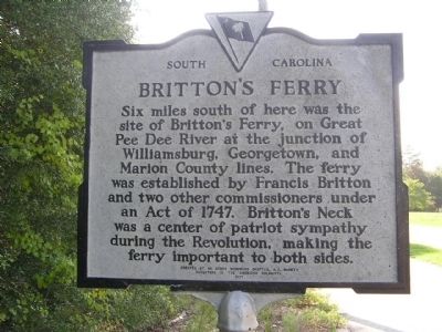
Britton's Neck / Britton's Ferry
Britton's Neck. One of the oldest settlements in Marion County, Britton's Neck lay between Great and Little Pee Dee Rivers extending northward from the mouth of Little Pee Dee. It was named for Francis, Timothy, Daniel, Moses, Joseph, and Philip Britton, who settled in the neck about 1735~36. They were the sons of Francis Britton, who was in Carolina by 1697.
Britton's Ferry. Six miles south of here was the site of Britton's Ferry, on Great Pee Dee River at the junction of Williamsburg, Georgetown, and Marion County lines. The ferry was established by Francis Britton and two other commissioners under an Act of 1747. Britton's Neck was a center of patriot sympathy during the American Revolution, making the ferry important to both sides.
Erected 1971 by Dr. Henry Woodward Chapter, S.C. Society Daughters of the American Colonists. (Marker Number 34-3.)
Topics and series. This historical marker is listed in these topic lists: Colonial Era • Patriots & Patriotism • War, US Revolutionary • Waterways & Vessels. In addition, it is included in the Daughters of the American Colonists series list. A significant historical year for this entry is 1697.
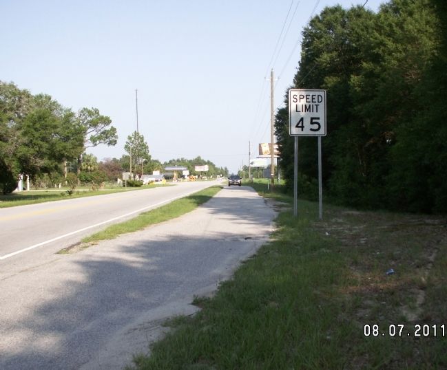
Location. 33° 51.977′ N, 79° 20.097′ W. Marker is near Britton's Neck, South Carolina, in Marion County. Marker is on U.S. 378 near South Carolina Highway 908, on the left when traveling west. Touch for map. Marker is in this post office area: Gresham SC 29546, United States of America. Touch for directions.
Other nearby markers. At least 8 other markers are within 7 miles of this marker, measured as the crow flies. Marion's Camp at Snow's Island (within shouting distance of this marker); Snow’s Island: Den of the Swamp Fox (approx. 1.7 miles away); Marion at Port’s Ferry / Asbury at Port’s Ferry (approx. 6.4 miles away); General Francis Marion (approx. 6.8 miles away); Witherspoon’s Ferry: Francis Marion Takes Command (approx. 6.8 miles away); Francis Marion at Witherspoon's Ferry (approx. 6.8 miles away); Witherspoon’s Ferry / Johnsonville (approx. 6.8 miles away); Johnsonville (approx. 6.8 miles away). Touch for a list and map of all markers in Britton's Neck.
More about this marker. Marker has a paved pull of area for viewing
Credits. This page was last revised on January 18, 2023. It was originally submitted on August 8, 2011, by Anna Inbody of Columbia, South Carolina. This page has been viewed 3,052 times since then and 238 times this year. Photos: 1, 2, 3. submitted on August 8, 2011, by Anna Inbody of Columbia, South Carolina. • Bill Pfingsten was the editor who published this page.


