Cascade near Colorado Springs in El Paso County, Colorado — The American Mountains (Southwest)
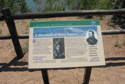
A Mountain of Many Names
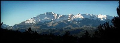
A “blue cloud” in the Distance. Lieutenant Zebulon Montgomery Pike was dispatched in 1806 to survey the southwest section of that recent purchase. Pike kept a journal detailing his travels and on November 15 he wrote about a mountain or blue cloud in the distance he called Grand Peak. Pike and his men attempted and failed to reach the summit due to a blizzard on November 24, 1806.
The first recorded ascent was in 1820 by botanist Dr. Edwin James. The leader of the expedition, Major Stephen H. Long, named the mountain James Peak in his honor. During the 1850s, Pikes Peak became the official name for the mountain.
The Pikes Peak or Bust gold rush of 1859 brought thousands of opportunity-seekers to the slopes of the mountain and national notoriety.
(caption: “I believe no human being could have ascended to its pinnacle.” Lt. Zebulon Pike, November 24, 1806.
Topics. This historical marker is listed in this topic list: Exploration. A significant historical year for this entry is 1803.
Location. 38° 55.301′ N, 105° 1.549′ W. Marker is near Colorado Springs, Colorado, in El Paso County. It is in Cascade. Marker is on Pike's Peak Toll Road. Marker is located at the Crystal Reservoir Visitor Center. Touch for map. Marker is in this post office area: Cascade CO 80809, United States of America. Touch for directions.
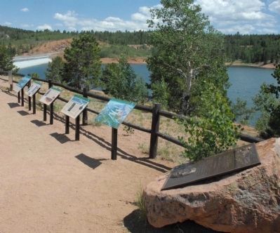
Other nearby markers. At least 8 other markers are within 3 miles of this marker, measured as the crow flies. Well-traveled Water (here, next to this marker); Test Your Bird I.Q. (here, next to this marker); The Making of America's Mountain (here, next to this marker); Take a Closer Look...Foothills Life Zone (here, next to this marker); Take a Closer Look...Montane Life Zone (here, next to this marker); Take a Closer Look...Alpine/Subalpine Life Zone (here, next to this marker); Pick a Climate (here, next to this marker); Welcome to America’s Mountain (approx. 2.4 miles away). Touch for a list and map of all markers in Colorado Springs.
Credits. This page was last revised on February 25, 2024. It was originally submitted on August 10, 2011, by Charles T. Harrell of Woodford, Virginia. This page has been viewed 751 times since then and 13 times this year. Photos: 1, 2. submitted on August 10, 2011, by Charles T. Harrell of Woodford, Virginia. 3. submitted on November 12, 2011. • Bill Pfingsten was the editor who published this page.


