Near Tularosa in Otero County, New Mexico — The American Mountains (Southwest)
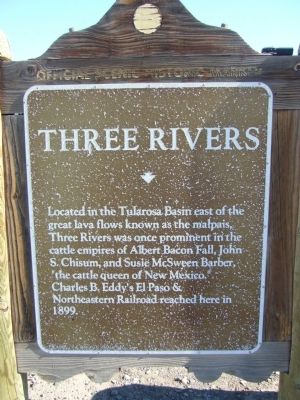
Three Rivers
Erected by New Mexico Historic Preservation Division.
Topics. This historical marker is listed in these topic lists: Notable Places • Railroads & Streetcars • Settlements & Settlers. A significant historical year for this entry is 1899.
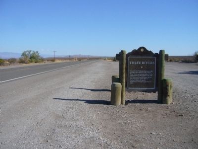
Location. Marker is missing. It was located near 33° 19.324′ N, 106° 4.69′ W. Marker was near Tularosa, New Mexico, in Otero County. Marker was at the intersection of U.S. 54 at milepost 96.6 and County Road B030, on the right when traveling north on U.S. 54. Touch for map. Marker was in this post office area: Tularosa NM 88352, United States of America. Touch for directions.
Other nearby markers. At least 4 other markers are within 17 miles of this location, measured as the crow flies. Three Rivers Petroglyph Site (a few steps from this marker); a different marker also named Three Rivers (a few steps from this marker); a different marker also named Three Rivers Petroglyph Site (approx. 4.3 miles away); Round Mountain (approx. 16.2 miles away).
More about this marker. The marker was removed and replaced by the "Nearby Marker" with the same name.

Photographed By Bill Kirchner, July 25, 2011
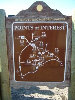
2. Back of Three Rivers Marker
Points of Interest
New Mexico's Historic Markers typically have a map on the back side showing the location of other OSHM's. This is an excellent source of information when exploring for other Historical Markers and locations.
New Mexico's Historic Markers typically have a map on the back side showing the location of other OSHM's. This is an excellent source of information when exploring for other Historical Markers and locations.
Credits. This page was last revised on June 16, 2016. It was originally submitted on August 12, 2011, by Bill Kirchner of Tucson, Arizona. This page has been viewed 650 times since then and 13 times this year. Photos: 1, 2, 3. submitted on August 12, 2011, by Bill Kirchner of Tucson, Arizona. • Syd Whittle was the editor who published this page.

