Burlington in Alamance County, North Carolina — The American South (South Atlantic)
Johnston Moves West
Logisticians at Work
— Carolinas Campaign —
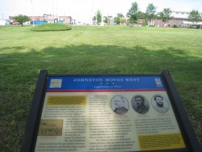
You are standing where the northern column of Confederate Gen. Joseph E. Johnston’s Army of Tennessee divided on April 15, 1865, as it maneuvered west away from Union Gen. William T. Sherman’s army. Confederate Gen. A.P. Stewart’s corps marched to Gibsonville along present day U.S. Route 70 while Gen. Stephen D. Lee’s corps, which Johnston accompanied, marched through Elon on today’s N.C. Route 100. The other Confederate column moved west through southern Alamance County as Johnston and Sherman began negotiating the inevitable Confederate surrender.
Johnston’s army was marching back up its supply lines as it moved west, meeting trains bringing food and equipment from Salisbury under the direction of Gen. P.G.T. Beauregard. The Confederate supply situation here contrasted sharply with that confronting Gen. Robert E. Lee when he evacuated Richmond and Petersburg on April 2–3 and marched west, away from his supply sources, planning to turn south and join Johnston. Lee lost valuable time at Jetersville waiting for supplies that never arrived, which enabled Federal cavalry to block his way south.
The soldiers in the Army of Tennessee revered Johnston, who was known for taking care to see that his men were well fed and supplied. While Johnston’s critics believed that he was overly cautious, most soldiers thought that he was unwilling to risk their lives unnecessarily. Johnston himself was concerned that he had been returned to command of the army to serve as a scapegoat for failure — a concern that later proved to be well founded.
(sidebar) Gen. Joseph Eggleston Johnston had a unique connection to Alamance County. Here, his father, Peter Johnston, and his father’s close friend, Joseph Eggleston, had fought under Lt. Col. Henry “Light-Horse Harry” Lee, Robert E. Lee’s father, during the Revolutionary War at an engagement known here as Pyle’s Hacking Match. Johnston was named for his father’s friend and carried his sword, refusing to leave the Seven Pines battlefield without it after he was wounded.
Erected by North Carolina Civil War Trails.
Topics and series. This historical marker is listed in this topic list: War, US Civil. In addition, it is included in the North Carolina Civil War Trails series list. A significant historical date for this entry is April 15, 1865.
Location. 36° 5.643′ N, 79° 26.173′ W. Marker is in Burlington, North Carolina, in Alamance County. Marker can be reached from South Main Street. Located at the Burlington Depot. Touch for map. Marker is at or near this postal address: 200 South Main Street, Burlington NC 27215, United States of America. Touch for directions.
Other nearby markers. At least 8 other markers are within 2 miles of this marker, measured as the crow flies. Norfolk & Western Caboose #518654 (within shouting distance of this marker); North Carolina Railroad (within shouting distance of this marker); Camp Alamance (within shouting distance of this marker); Cammack Building (about 600 feet away, measured in a direct line); Pine Hill Cemetery - Veterans Memorial (approx. 0.8 miles away); Dentzel Carousel (approx. 1.1 miles away); J. Spencer Love (approx. 1.2 miles away); Pioneer Plant (approx. 1.3 miles away). Touch for a list and map of all markers in Burlington.
Credits. This page was last revised on May 17, 2023. It was originally submitted on August 12, 2011, by Dave Simpson of Durham, North Carolina. This page has been viewed 829 times since then and 45 times this year. Last updated on May 9, 2023, by Michael Buckner of Durham, North Carolina. Photo 1. submitted on August 12, 2011, by Dave Simpson of Durham, North Carolina. • J. Makali Bruton was the editor who published this page.
Editor’s want-list for this marker. A wide shot of the marker in context. • Can you help?
