Newington in Hartford County, Connecticut — The American Northeast (New England)
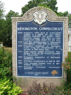
Newington, Connecticut
1671 – Land first divided among 76 Wethersfield householders. (The Mile – in – Breadth).
1677 – Permanent settlement in Newington began with the establishment of a sawmill at Mill Pond Falls.
1721 – Town legally named Newington (New Meadow Town) by the General Assembly of Connecticut.
1754 – Permanent boundaries of Newington established.
1871 – Newington incorporated on July 10, 1871.
1966 – Town Manager-Council form of government introduced.
1971 – Newington Centennial Anniversary observed.
The Connecticut Historical Commission
The Newington Centennial Commission
1971
Erected 1971 by the Connecticut Historical Commission and the Newington Centennial Commission.
Topics. This historical marker is listed in these topic lists: Colonial Era • Settlements & Settlers. A significant historical month for this entry is July 2005.
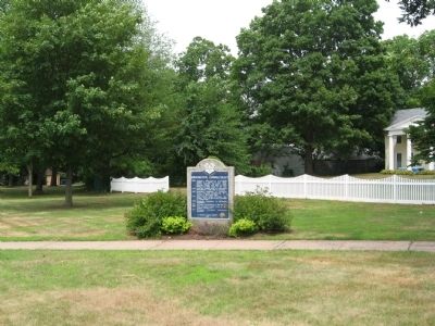
Location. 41° 41.925′ N, 72° 43.431′ W. Marker is in Newington, Connecticut, in Hartford County. Marker is at the intersection of Main Street and Cedar Street, on the left when traveling south on Main Street. Located in the Center Green. Touch for map. Marker is in this post office area: Newington CT 06111, United States of America. Touch for directions.
Other nearby markers. At least 8 other markers are within 3 miles of this marker, measured as the crow flies. Newington World War I Monument (within shouting distance of this marker); Newington Veterans Memorial (approx. 0.3 miles away); First U.S. Girl Scout Day Camp (approx. half a mile away); National Iwo Jima Memorial (approx. 1.8 miles away); Brig. Gen. John Patterson House (approx. 2.2 miles away); Burgoyne Elms (approx. 2.4 miles away); Burgoyne Rest (approx. 2.4 miles away); Belvidere Area WWII Veterans (approx. 2˝ miles away). Touch for a list and map of all markers in Newington.
Also see . . .
1. Town of Newington. (Submitted on August 13, 2011, by Michael Herrick of Southbury, Connecticut.)
2. Newington, Connecticut on Wikipedia. (Submitted on August 13, 2011, by Michael Herrick of Southbury, Connecticut.)
Credits. This page was last revised on June 16, 2016. It was originally submitted on August 13, 2011, by Michael Herrick of Southbury, Connecticut. This page has been viewed 778 times since then and 16 times this year. Photos: 1, 2. submitted on August 13, 2011, by Michael Herrick of Southbury, Connecticut.

