Hatteras in Dare County, North Carolina — The American South (South Atlantic)
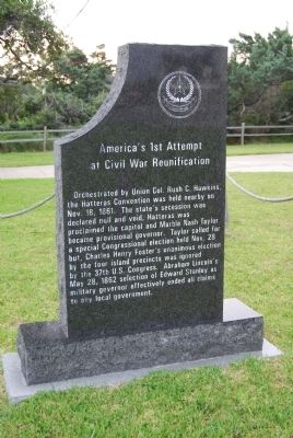
America's 1st Attempt at Civil War Reunification
Inscription.
Orchestrated by Union Colonel Rush C. Hawkins, the Hatteras Convention was held nearby on November 18, 1861. The state's secession was declared null and void, Hatteras was proclaimed the capitol and Marble Nash Taylor became provisional governor. Taylor called for a special Congressional election held November 28 but, Charles Henry Foster's unanimous election by the four island precincts was ignored by the 37th United States Congress. Abraham Lincoln's May 28, 1862 selection of Edward Stanley as military governor effectively ended all claims to local government.
Topics and series. This historical marker is listed in these topic lists: Government & Politics • War, US Civil. In addition, it is included in the Former U.S. Presidents: #16 Abraham Lincoln series list. A significant historical date for this entry is May 28, 1849.
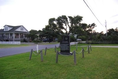
Location. 35° 13.201′ N, 75° 41.403′ W. Marker is in Hatteras, North Carolina, in Dare County. Marker is on Kohler Road, 0 miles east of North Carolina Highway 12, on the right when traveling east. Located across Kohler Road from the US Weather Bureau Station in Hatteras Village. Touch for map. Marker is in this post office area: Hatteras NC 27943, United States of America. Touch for directions.
Other nearby markers. At least 8 other markers are within 2 miles of this marker, measured as the crow flies. Storm Watch (a few steps from this marker); U.S.S. Monitor (approx. 0.6 miles away); Billy Mitchell (approx. 0.6 miles away); Welcome to Hatteras Village (approx. one mile away); Island Veterans of the Civil War / America's 1st Amphibious Assault of the Civil War (approx. one mile away); Welcome to captivating Hatteras Island… (approx. 1.1 miles away); Confederate Forts (approx. 1.1 miles away); Propeller From USS Dionysus (approx. 1.2 miles away). Touch for a list and map of all markers in Hatteras.

Photographed By Mike Wintermantel, August 14, 2011
3. America's 1st Attempt at Civil War Reunification Marker
Side B
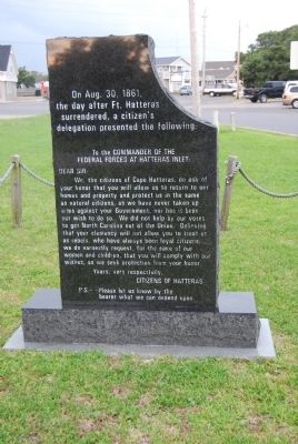
On Aug. 30, 1861 the day after Ft. Hatteras surrendered, a citizen's delegation presented the following:
To the Commander of the Federal Forces at Hatteras Inlet:
Dear Sir,
We, the citizens of Cape Hatteras, do ask of your honor that you will allow us to return to our homes and property and protect us in the same as natural citizens, as we have never taken up arms against your Government, nor has it been our wish to do so. We did not help by our votes to get North Carolina out of the Union. Believing that your clemency will not allow you to treat us as rebels, who have always been loyal citizens, we do earnestly request, for the sake of our women and children, that you will comply with our wishes, as we seek protection from your honor.
Yours, very respectfully,
Citizens of Hatteras
P.S. - - Please let us know by the bearer what we can depend on.
Credits. This page was last revised on October 13, 2022. It was originally submitted on August 14, 2011, by Mike Wintermantel of Pittsburgh, Pennsylvania. This page has been viewed 1,066 times since then and 30 times this year. Last updated on October 12, 2022, by Carl Gordon Moore Jr. of North East, Maryland. Photos: 1, 2, 3. submitted on August 14, 2011, by Mike Wintermantel of Pittsburgh, Pennsylvania. • Bernard Fisher was the editor who published this page.

