Lexington in Lafayette County, Missouri — The American Midwest (Upper Plains)
The Battle of Lexington
Sept. 18, 19 and 20, 1861
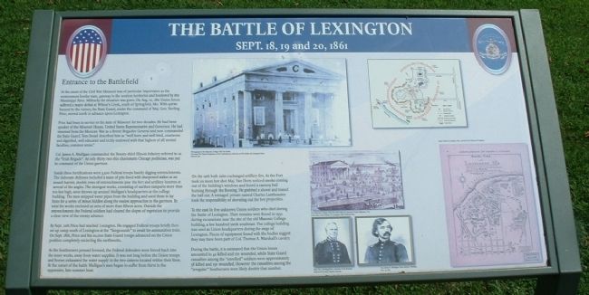
— Entrance to the Battlefield —
Inscription.
At the onset of the Civil War Missouri was of particular importance as the westernmost border state, gateway to the western territories and bordered by the Mississippi River. Militarily the situation was grave. On Aug. 10, 1861 Union forces suffered a major defeat at Wilson’s Creek, south of Springfield, Mo. With spirits buoyed by the victory, the State Guard, under the command of Maj. Gen. Sterling Price, moved north to advance upon Lexington.
Price had been in service to the state of Missouri for two decades. He had been speaker of the Missouri House, United States Representative and Governor. He had returned from the Mexican War as a Brevet Brigadier General and now commanded the State Guard. Tom Snead described him as “well born and well bred, courteous and dignified, well educated and richly endowed with that highest of all mental faculties, common sense.”
Col. James A. Mulligan commanded the Twenty-third Illinois Infantry referred to as the “Irish Brigade”. At only thirty-two this charismatic Chicago politician, was put in command of the Union garrison.
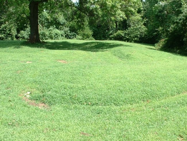
Inside these fortifications were 3,500 Federal troops hastily digging entrenchments. The elaborate defenses included a maze of pits lined with sharpened stakes as an assault barrier, double rows of entrenchments near the fort and artillery lunettes at several of the angles. The strongest works, consisting of earthen ramparts more than ten feet high, were thrown up around Mulligan’s headquarters at the college building. The men stripped water pipes from the building and used them to lay fuses for a series of mines hidden along the easiest approaches to the garrison. In total the works enclosed an area of more than fifteen acres. Outside the entrenchments the Federal soldiers had cleared the slopes of vegetation to provide a clear view of the enemy advance.
By Sept. 12th Price had reached Lexington. He engaged Federal troops briefly then set up camp south of Lexington at the “fairgrounds” to await his ammunition train. On Sept. 18th, Price and his 20,000 State Guard troops advanced on the Union position completely encircling the earthworks.
As the Southerners pressed forward, the Federal defenders were forced back into the inner works, away from water supplies. It was not long before the Union troops and horses exhausted the water supply in the two cisterns located within their lines. At the outset of the battle Mulligan’s men began to suffer from thirst in the oppressive, late summer heat.
On the 19th both sides exchanged artillery fire. As the Fort took on more hot shot Maj. Van Horn noticed smoke coming out of the building’s windows and found a cannon
ball burning through the flooring. He grabbed a shovel and tossed the ball out. A teenaged private named Charles Lantheaume took the responsibility of shoveling out the hot projectiles.
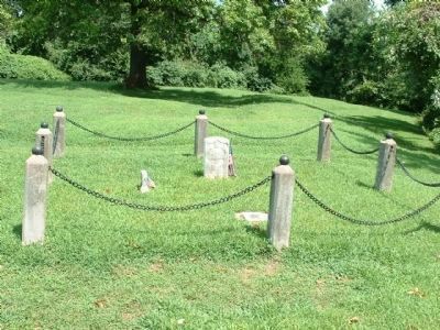
To the east lie five unknown Union soldiers who died during the Battle of Lexington. Their remains were found in 1932 during excavations near the site of the old Masonic College building, a few hundred yards southeast. The college building was used as Union headquarters during the siege of Lexington. Pieces of equipment found with the bodies suggest they may have been part of Col. Thomas A. Marshall’s cavalry.
During the battle, it is estimated that the Union losses amounted to 40 killed and 120 wounded, while State Guard casualties among the “enrolled” soldiers were approximately 38 killed and 150 wounded. However the casualties among the “irregular” Southerners were likely double that number.
Topics. This historical marker is listed in this topic list: War, US Civil. A significant historical month for this entry is September 1945.
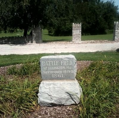
Location. 39° 11.464′ N, 93° 52.68′ W. Marker is in Lexington, Missouri, in Lafayette County. Marker is on Wood Street, 0.1 miles east of 13th Street. This marker is very near the main entrance to the battlefield on Wood Street. Touch for map. Marker is in this post office area: Lexington MO 64067, United States of America. Touch for directions.
Other nearby markers. At least 8 other markers are within
walking distance of this marker. A different marker also named The Battle of Lexington (about 300 feet away, measured in a direct line); a different marker also named The Battle of Lexington (about 400 feet away); a different marker also named The Battle of Lexington (about 700 feet away); a different marker also named The Battle of Lexington (approx. 0.2 miles away); Guibor's Battery (approx. 0.4 miles away); The Library Building (approx. 0.4 miles away); Mount Vernon Foundation Stones (approx. 0.4 miles away); Christ Church (approx. half a mile away). Touch for a list and map of all markers in Lexington.
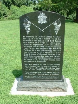
Photographed By Tony Meyers, August 10, 2011
5. Union Memorial (front) - Near Gravesite at Entrance to Battlefield
In memory of Colonel James Adelbert Mulligan and the member of his command who fought and died during the battle and siege of Lexington, Missouri, September 12-20, 1861. Colonel Mulligan commanded Union volunteers from Illinois and Missouri who fortified College Hill and stubbornly resisted the attacks of the Missouri State Guard forces of General Sterling Price. With their ammunition, water and rations depleted and reinforcements unable to reach them, Mulligan’s forces were compelled to surrender.
May the people of the United States never forget the Union defenders of Lexington, who suffered and died that this nation might live forever free.
“they determined to do their duty at all hazards.” Colonel James A. Mulligan
Erected in 2009 by the Department of Missouri, Sons of Union Veterans of the Civil War.
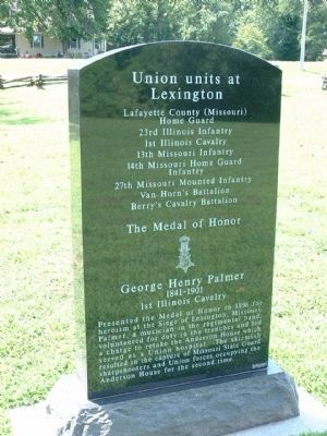
Photographed By Tony Meyers, August 10, 2011
6. Union Memorial (back) - Near Gravesite at Entrance to Battlefield
Union units at Lexington
Lafayette County (Missouri) Home Guard
23rd Illinois Infantry
1st Illinois Cavalry
1st Illinois Cavalry
13th Missouri Infantry
14th Missouri Home Guard Infantry
27th Missouri Mounted Infantry
Van Horn’s Battalion
Berry’s Cavalry Battalion
The Medal of Honor
George Henry Palmer
1841-1901
1st Illinois Cavalry
Presented the Medal of Honor in 1896 for heroism at the Siege of Lexington, Missouri. Palmer, a musician in the regimental band, volunteered for duty in the trenches and led a charge to retake the Anderson House which served as a Union hospital. The skirmish resulted in the capture of Missouri State Guard sharpshooters and Union forces occupying the Anderson House for the second time.
Credits. This page was last revised on June 16, 2016. It was originally submitted on August 14, 2011, by Tony Meyers of Liberty, Missouri. This page has been viewed 1,019 times since then and 29 times this year. Photos: 1, 2, 3, 4, 5, 6. submitted on August 14, 2011, by Tony Meyers of Liberty, Missouri. • Craig Swain was the editor who published this page.
