Morgan Hill in Santa Clara County, California — The American West (Pacific Coastal)
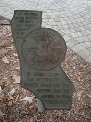
De Anza Expedition 1775 - 1776
Inscription.
Lt. Colonel Juan Bautista de Anza and party crossed this area in March 1778, in route to select sites for the Presidio and the Mission of San Francisco.
In the center of the marker is a circular motif, designed by Doris Birkland Beezley, of a rider superimposed upon a sun-like set of compass points, with the "De Anza Expedition 1775 1776" written above the rider.
Topics and series. This historical marker is listed in this topic list: Exploration. In addition, it is included in the Juan Bautista de Anza National Historic Trail series list. A significant historical month for this entry is March 1778.
Location. 37° 8.067′ N, 121° 39.458′ W. Marker is in Morgan Hill, California, in Santa Clara County. Marker is on Monterey Road (Highway 82), on the right when traveling south. The marker is on the grounds of the Morgan Hill History Museum. Touch for map. Marker is at or near this postal address: 17860 Monterey Road, Morgan Hill CA 95037, United States of America. Touch for directions.
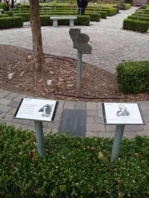
Other nearby markers. At least 8 other markers are within walking distance of this marker. [Morgan Hill] Centennial Project (here, next to this marker); 21 Mile House (here, next to this marker); St. Martin Catholic Church (here, next to this marker); Murphy-Stephens-Townsend Party (here, next to this marker); Rancho Ojo de Agua de la Coche (here, next to this marker); Catherine O’Toole Murphy Dunne (here, next to this marker); First Morgan Hill Library (here, next to this marker); Burnett School (here, next to this marker). Touch for a list and map of all markers in Morgan Hill.
Credits. This page was last revised on June 16, 2016. It was originally submitted on August 15, 2011, by Barry Swackhamer of Brentwood, California. This page has been viewed 620 times since then and 11 times this year. Photos: 1, 2, 3. submitted on August 14, 2011, by Barry Swackhamer of Brentwood, California. • Syd Whittle was the editor who published this page.


![[Morgan Hill] Centennial Project Markers and History Trail. Click for full size. [Morgan Hill] Centennial Project Markers and History Trail image. Click for full size.](Photos1/167/Photo167898.jpg?815201145000PM)