Near Lumpkin in Stewart County, Georgia — The American South (South Atlantic)
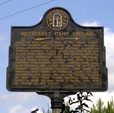
Methodist Camp Ground
»—¼ Mi. S. →
Erected 1956 by Georgia Historical Commission. (Marker Number 128-13.)
Topics and series. This historical marker is listed in this topic list: Churches & Religion. In addition, it is included in the Georgia Historical Society series list. A significant historical year for this entry is 1830.
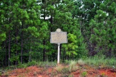
Location. 32° 3.136′ N, 84° 44.517′ W. Marker is near Lumpkin, Georgia, in Stewart County. Marker is at the intersection of Georgia Route 27 and Parker Road (County Route 82), on the right when traveling east on State Route 27. Touch for map. Marker is in this post office area: Lumpkin GA 31815, United States of America. Touch for directions.
Other nearby markers. At least 8 other markers are within 4 miles of this marker, measured as the crow flies . Jackson Trail (approx. 0.4 miles away); Westville Symposium / Academic Pioneers (approx. 2.7 miles away); Stewart County Academy and Masonic Building (approx. 3 miles away); Lumpkin and Stewart County (approx. 3.1 miles away); County Courthouse (approx. 3.1 miles away); Our Soldiers (approx. 3.1 miles away); Bedingfield Inn (approx. 3.1 miles away); John Wellborn Root Birthplace Site (approx. 3.2 miles away). Touch for a list and map of all markers in Lumpkin.
Credits. This page was last revised on February 1, 2020. It was originally submitted on December 18, 2008, by David Seibert of Sandy Springs, Georgia. This page has been viewed 908 times since then and 10 times this year. Last updated on August 21, 2011, by David Seibert of Sandy Springs, Georgia. Photos: 1. submitted on December 18, 2008, by David Seibert of Sandy Springs, Georgia. 2. submitted on August 30, 2011, by David Seibert of Sandy Springs, Georgia. • Bill Pfingsten was the editor who published this page.

