Near Madison Heights in Amherst County, Virginia — The American South (Mid-Atlantic)
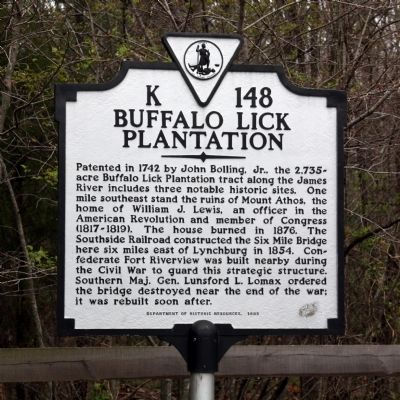
Buffalo Lick Plantation
Erected 1995 by Department of Historic Resources. (Marker Number K-148.)
Topics and series. This historical marker is listed in these topic lists: Landmarks • War, US Civil. In addition, it is included in the Virginia Department of Historic Resources (DHR) series list. A significant historical year for this entry is 1742.
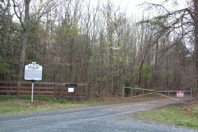
Location. 37° 24.269′ N, 79° 4.632′ W. Marker is near Madison Heights, Virginia, in Amherst County. Marker is on Riverview Road (County Route 672) east of U.S. 29, on the left. Take the Madison Heights exit on Route 29, just north of the James River, but take a left turn at the bottom of the ramp, away from Madison Heights. Touch for map. Marker is in this post office area: Madison Heights VA 24572, United States of America. Touch for directions.
Other nearby markers. At least 8 other markers are within 4 miles of this marker, measured as the crow flies. Mount Athos (approx. 1.4 miles away); Megginson Rosenwald School (approx. 1.7 miles away); Central Virginia Training Center (approx. 2˝ miles away); Oxford Furnace (approx. 2.8 miles away); Lynchburg Defenses (approx. 3 miles away); Percival's Island Overlook (approx. 3.2 miles away); Lynchburg History (approx. 3.3 miles away); Luke Jordan, Blues Pioneer (approx. 3.3 miles away). Touch for a list and map of all markers in Madison Heights.
More about this marker. A marker with this same number but titled “Mount Athos” was originally erected in the late 1920s across the river on US 460, 6 miles east of Lynchburg. It read “Two miles north are the ruins of Mouth Athos, or Buffalo Lick Plantation. The house was built in 1796 by William J. Lewis, who commanded a corps of mountain riflemen at the siege of Yorktown in 1781.” It was reported missing before 1989.
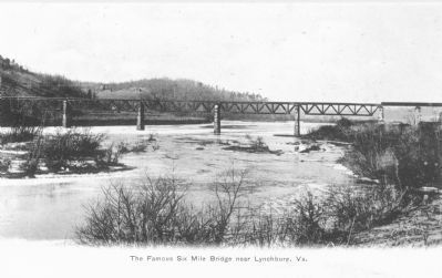
Credits. This page was last revised on June 16, 2016. It was originally submitted on August 21, 2011, by J. J. Prats of Powell, Ohio. This page has been viewed 1,810 times since then and 52 times this year. Photos: 1, 2. submitted on August 21, 2011, by J. J. Prats of Powell, Ohio. 3. submitted on September 1, 2011, by J. J. Prats of Powell, Ohio.
Editor’s want-list for this marker. Photos of the ruins of Buffalo Lick Plantation • Photos of the remains of Fort Riverview • Photos of the remains of Six Mile Bridge • Can you help?


