Earlewood in Columbia in Richland County, South Carolina — The American South (South Atlantic)
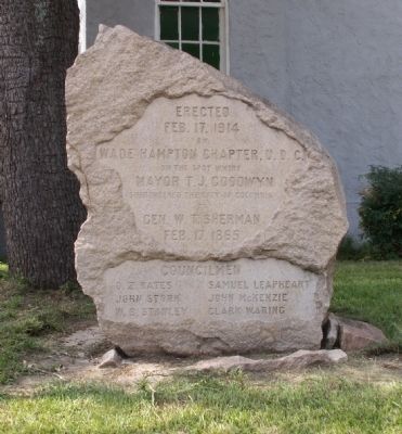
Site of the Surrender of Columbia, SC
Feb. 17, 1914
by
Wade Hampton Chapter, U.D.C.
On the spot where
Mayor T.J. Goodwyn
surrendered the city of Columbia
to
Gen. W.T. Sherman
Feb. 17, 1865
Councilmen
O.Z. Bates • Samuel Leapheart
John Stork • John McKenzie
W.B. Stanley • Clark Waring
Erected 1914 by Wade Hampton Chapter, U.D.C.
Topics and series. This historical marker is listed in this topic list: War, US Civil. In addition, it is included in the United Daughters of the Confederacy series list. A significant historical month for this entry is February 1836.
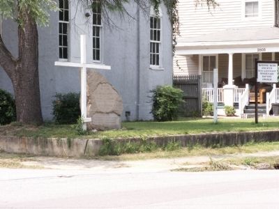
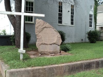
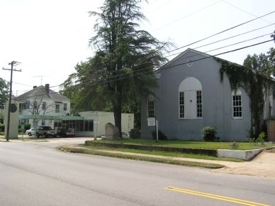
Location. 34° 1.346′ N, 81° 2.776′ W. Marker is in Columbia, South Carolina, in Richland County. It is in Earlewood. Marker is at the intersection of River Drive and Beaufort Street, on the left when traveling west on River Drive. Touch for map. Marker is in this post office area: Columbia SC 29201, United States of America. Touch for directions.
Other nearby markers. At least 8 other markers are within walking distance of this marker. Geiger Ave. Cemetery (approx. 0.4 miles away); I. DeQuincey Newman Freeway (approx. half a mile away); Confederate Soldiers Home (approx. half a mile away); S.C. Confederate Soldiers’ Home (approx. half a mile away); Confederate Soldiers 1861-1865 (approx. 0.7 miles away); Unknown Confederate Dead Monument (approx. 0.7 miles away); Elmwood Cemetery Confederate Soldiers (approx. 0.7 miles away); State Fairgrounds (approx. ¾ mile away). Touch for a list and map of all markers in Columbia.
Additional commentary.
1.
After briefly shelling Columbia on February 16, 1865, Sherman's 15th Corps under Major General John A. Logan crossed the Saluda River without opposition. On the peninsula between the Saluda and Broad Rivers north of Columbia, Wheeler's Rear Guard offered stiff resistance and burned the bridge over the Broad River, briefly slowing the Federal advance. Federal engineers laid a pontoon bridge over the Broad River during the night of the 16th/17th. General Wade Hampton informed Mayor T.J. Goodwyn that his troops would evacuate Columbia on the morning of the 17th. Hampton left the Mayor in charge of the City and instructed him to surrender it to the Federal forces that day. Between 8 o'clock and 9 o'clock a.m., Hampton personally ordered Goodwyn to leave immediately to meet the advancing Federal columns, which had crossed the Broad River above Columbia and were moving rapidly southward towards the city. The surrender party, consisting of Goodwyn and Alderman Bates, Stork, and McKenzie, rode in a carriage carrying a white flag to this site and sought protection for Columbia. Sherman's troops burned the city later that day.
Mrs. Clark Waring, president of the Wade Hampton Chapter, presided over the dedication ceremony on February 14th, 1914. Alice Earle, president of the South Carolina U.D.C., introduced the speaker, Norton W. Brooker, the sole living witness to the surrender. Mayor W.H. Gibbs accepted the 5 foot boulder of Richland Granite. Six boys and girls, descendants of Mayor Goodwyn, unveiled the marker.
— Submitted August 24, 2011, by Anna Inbody of Columbia, South Carolina.
Credits. This page was last revised on February 16, 2023. It was originally submitted on August 24, 2011, by Anna Inbody of Columbia, South Carolina. This page has been viewed 3,221 times since then and 104 times this year. Photos: 1, 2. submitted on August 24, 2011, by Anna Inbody of Columbia, South Carolina. 3. submitted on August 16, 2013, by Bill Coughlin of Woodland Park, New Jersey. 4. submitted on August 24, 2011, by Anna Inbody of Columbia, South Carolina. • Craig Swain was the editor who published this page.


