Perryville in Boyle County, Kentucky — The American South (East South Central)
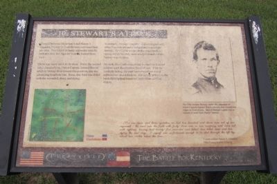
Stewart's Attack
Perryville • The Battle For Kentucky
— October 8, 1862 —
There was more work to be done. From the second ridge ahead of you, Union captain Samuel Harris’ artillery battery fired toward this position, into the advancing Southern line. Soon, this field was filled with the wounded, dead, and dying.
Eventually, Stewart’s regiments intermingled with other Confederate units and pressed toward the battery. The Union troops on the ridge made a strong stand, but they were overwhelmed and the battery was overrun.
By dark, the Confederates had pushed the Federal soldiers past the ridges in front of you. With the sunlight fading, Stewart’s command ran out of ammunition and withdrew. His timely arrival on the battlefield helped ensure a Confederate tactical victory.
...[I]n one hour and three-quarters we lost two hundred and eleven men out of our regiment. We went into the fight with forty-three men in our company and came out with eighteen, having had twenty-five wounded and killed; two killed dead and two dying the next day. I myself was unfortunate enough to be shot through the left leg, about two inches below the knee...
Union soldier Adam S. Johnson
79th Pennsylvania Infantry
Topics. This historical marker is listed in this topic list: War, US Civil.
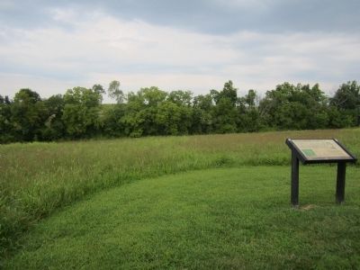
Location. Marker has been reported missing. It was located near 37° 40.315′ N, 84° 58.428′ W. Marker was in Perryville, Kentucky, in Boyle County. Marker could be reached from Park Road west of Battlefield Road (Kentucky Route 1920). Located in Perryville Battlefield State Historic Site. Touch for map. Marker was at or near this postal address: 1825 Battlefield Road, Perryville KY 40468, United States of America. Touch for directions.
Other nearby markers. At least 8 other markers are within walking distance of this location. The Bloodbath at the Crib (about 300 feet away, measured in a direct line); Act of Mercy (about 700 feet away); Widow Gibson Cabin (about 800 feet away); Starkweather's Hill (approx. 0.2 miles away); Sanctuary (approx. 0.2 miles away); “For God’s Sake, Save That Battery” The 38th Indiana at Perryville (approx. 0.2 miles away); a different marker also named Starkweather’s Hill (approx. ¼ mile away); Starkweather's Wall: Highwatermark of the West (approx. ¼ mile away). Touch for a list and map of all markers in Perryville.
More about this marker. On the upper right is a photograph with the caption, “The 19th Indiana battery, under the command of Union Captain Samuel Harris (above), was located two ridges in front of you. One of Stewart’s goals was to capture or push back Harris’ battery.
Credits. This page was last revised on May 18, 2021. It was originally submitted on August 25, 2011, by Bernard Fisher of Richmond, Virginia. This page has been viewed 997 times since then and 91 times this year. Photos: 1, 2. submitted on August 25, 2011, by Bernard Fisher of Richmond, Virginia.

