Boscobel in Grant County, Wisconsin — The American Midwest (Great Lakes)
Crossing the River
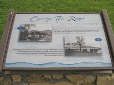
In 1871, the Wisconsin legislature authorized the city of Boscobel to bridge the Wisconsin River and to collect tolls. Between 1874 and 1875 a timber and iron bridge measuring 700 feet was constructed, at a cost of about $26,000. Sometime after its completion portions of the bridge was covered.
In 1935 the Wisconsin Legislature set aside funds to construct a new bridge at Boscobel. With the change to automobile travel, the old bridge was outdated and no longer safe. The State Highway Commission prepared the plans for a 1209-foot long bridge. It consisted of seven Parker overhead truss spans and a simple concrete girder at the north end.
Erected by the Wisconsin Department of Transportation and the Wisconsin Historical Society.
Topics. This historical marker is listed in this topic list: Bridges & Viaducts. A significant historical year for this entry is 1864.
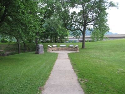
Location. 43° 8.98′ N, 90° 42.892′ W. Marker is in Boscobel, Wisconsin, in Grant County. Marker can be reached from Elm Street (U.S. 61) 0.3 miles south of State Highway 60, on the left when traveling north. Marker is at the Floyd Von Haden Boat Landing & Recreation Area. Touch for map. Marker is in this post office area: Boscobel WI 53805, United States of America. Touch for directions.
Other nearby markers. At least 8 other markers are within 14 miles of this marker, measured as the crow flies. Boscobel - A River Town (here, next to this marker); Trade Links – River Borne (here, next to this marker); The River (here, next to this marker); The Gideons (approx. 2.2 miles away); The "Dinky" (approx. 11.7 miles away); Beauford T. Anderson (approx. 12.4 miles away); Gays Mills Apple Orchards (approx. 13.1 miles away); Gays Mills Sesquicentennial (approx. 13˝ miles away). Touch for a list and map of all markers in Boscobel.
More about this marker. Photo captions:
1874. The toll collector's house was located in the general vincinity of this park. The minimum toll rate was 10 cents. In 1918 the bridge became part of the state highway system. Tolls were abolished in 1928 when the State Highway Commission purchased the bridge from the city.
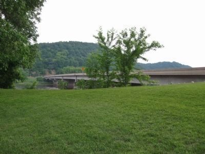
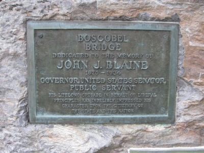
1937. The $350,000 bridge opened with great fanfare on November 11th, 1937. The bridge was dedicated to Boscobel resident John J. Blaine, who had served as Governor of Wisconsin and US Senator. The bridge you see today was completed in 2000 at a cost of $3,400,000.
Also see . . .
1. Boscobel Bridge. Photos of the 2000 bridge. (Submitted on September 2, 2011.)
2. Covered Bridge in Boscobel. Photo of the 1874 bridge. (Submitted on September 2, 2011.)
Photographed By K. Linzmeier, June 18, 2011
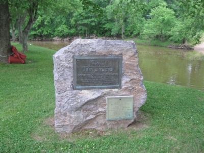
5. Boscobel Bridge
Dedicated to the memory of John J. Blaine 1875-1934· Governor, United States Senator, Public Servant · His lifelong crusade in behalf of liberal principles has indelibly impressed his character upon the citizenry of the State and the Nation.
Photographed By K. Linzmeier, June 18, 2011
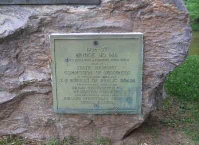
6. 1936-37 Bridge No. 146
State Proj. 9451 & Federal Proj. 376-E · Built by State Highway Commission of Wisconsin in cooperation with the U.S. Bureau of Public Roads · Substructure contractor Kramp Construction Co. Milwaukee, Wisconsin · Superstructure contractor Midland Structural Steel Co. Cicero, Illinois
Credits. This page was last revised on December 7, 2021. It was originally submitted on September 2, 2011, by Keith L of Wisconsin Rapids, Wisconsin. This page has been viewed 658 times since then and 29 times this year. Photos: 1, 2, 3, 4, 5, 6. submitted on September 2, 2011, by Keith L of Wisconsin Rapids, Wisconsin.
