Historic District in St. Augustine in St. Johns County, Florida — The American South (South Atlantic)
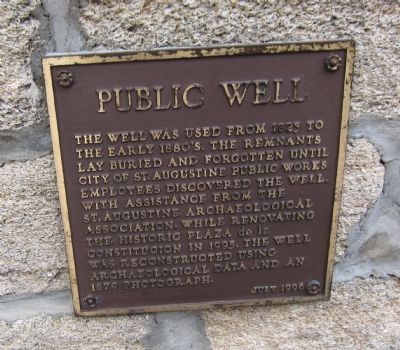
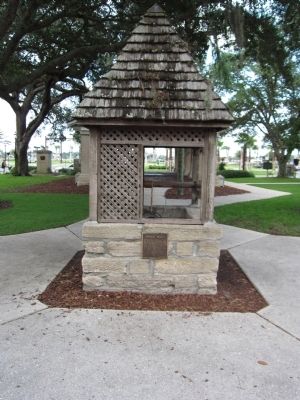
Public Well
Erected 1996.
Topics. This historical marker is listed in this topic list: Notable Buildings. A significant historical year for this entry is 1823.
Location. 29° 53.553′ N, 81° 18.708′ W. Marker is in St. Augustine, Florida, in St. Johns County. It is in the Historic District. Marker is at the intersection of King Street and Charlotte Street, on the left when traveling east on King Street. Located in the Plaza de la Constitucion. Touch for map. Marker is in this post office area: Saint Augustine FL 32084, United States of America. Touch for directions.
Other nearby markers. At least 8 other markers are within walking distance of this marker. World War II Memorial (a few steps from this marker); Cast Iron Gun (a few steps from this marker); Slave Market (within shouting distance of this marker); St. Augustine Foot Soldiers (within shouting distance of this marker); The St. Augustine Foot Soldiers Monument (within shouting distance of this marker); Public Market Place (within shouting distance of this marker); Juan Ponce de Leon (within shouting distance of this marker); 31 King Street (within shouting distance of this marker). Touch for a list and map of all markers in St. Augustine.
Credits. This page was last revised on January 2, 2019. It was originally submitted on September 3, 2011, by Craig Swain of Leesburg, Virginia. This page has been viewed 770 times since then and 64 times this year. Photos: 1, 2. submitted on September 3, 2011, by Craig Swain of Leesburg, Virginia.

