Merriam in Johnson County, Kansas — The American Midwest (Upper Plains)
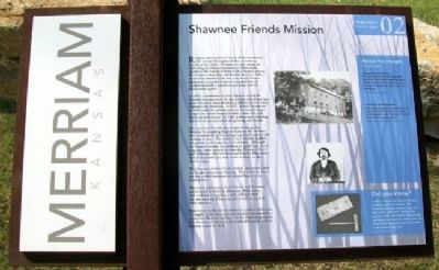
Shawnee Friends Mission
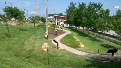
Merriam Historic Plaza Walking Path
Religious missionaries of nearly all denominations were present throughout Indian settlements as early as the 1680’s. Missionaries were intent on converting the Native Americans to Christianity. Quakers (The Society of Friends) had worked among the Shawnee when they still lived in the Ohio Valley. As the tribe moved to the area that would become Johnson County, the Shawnee requested that the Quakers establish a school among them, and the missionaries agreed.
In 1833, a committee of three Quakers visited the Shawnee in preparation for the mission school and was given 320 acres, most of which is within the city limits of present day Merriam. In 1837, Moses Pearson and his wife made the arduous journey by covered wagon to open the school located at what is now 61st and Hemlock in Merriam. In 1845, a three-story building was built to accommodate the growing enrollment.
The Society of Friends also sought to change the Shawnee by assigning English names to the children who attended the school and giving them English-style clothing to wear. The children were clothed and fed completely at the expense of the mission. Although the Quakers forbade the children to speak their native language, some sources indicate that Shawnee Chief and Methodist Minister Reverend Charles Bluejacket visited the school and read to the children in their native tongue.
The Shawnee children lived, worked, and prayed with the Quaker missionary families. They spent six hours per day in the classroom and several hours doing manual labor.
The entire community, both Friends and Shawnee, participated in worship, education, Bible study, and meditation together, a style different from the rote method of learning and preaching used at other missions.
Enrollment in the school reached its peak in 1864 with 76 pupils. In its later years, the mission was primarily a school for Shawnee orphans. As the Shawnee gradually left the area, the necessity for a school lessened, and, the mission closed in 1870.
About the Images
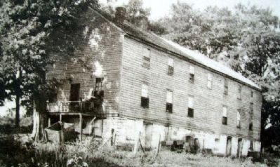
Shawnee Friends Mission -
The Quaker Mission included a large frame house built of solid walnut, measuring seventy-five feet long and forty feet wide. Each board and beam was hand sawed, and the nails were hand-forged.
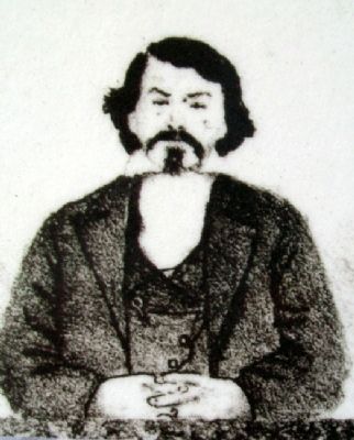
Reverend Charles Bluejacket -
Chief Charles Bluejacket was perhaps one of the most successful Shawnee farmers. A minister and distinguished leader, Bluejacket was widely known for his bountiful orchards.
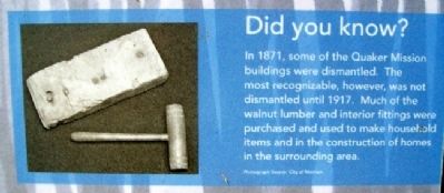
Did you know?
In 1871, some of the Quaker Mission buildings were dismantled. The most recognizable, however, was not dismantled until 1917. Much of the walnut lumber and interior fittings were purchased
and used to make household items and in the construction of homes in the surrounding area.
Erected 2006 by City of Merriam. (Marker Number 02.)
Topics and series. This historical marker is listed in these topic lists: Churches & Religion • Education • Native Americans. In addition, it is included in the Quakerism series list. A significant historical year for this entry is 1833.
Location. 39° 0.873′ N, 94° 41.45′ W. Marker is in Merriam, Kansas, in Johnson County. Marker is at the Merriam Visitors Bureau, near Exit #228B of Interstate 35, and immediately southwest of the intersection of Shawnee Mission Parkway (US 56) and Eby Avenue. Touch for map. Marker is at or near this postal address: 6304 East Frontage Road, Mission KS 66202, United States of America. Touch for directions.
Other nearby markers. At least 8 other markers are within walking distance of this marker. The Overland Trails (here, next to this marker); The People of the South Wind & the Coming of the Shawnee (here, next to this marker); The Founding of Campbellton (a few steps from this marker); Merriam Park & George Kessler (a few steps from this marker); The Trolley Line & Hocker Grove Amusement Park (a few steps from this marker); The Bear Pit (within shouting distance of this marker); Education in Merriam
(within shouting distance of this marker); The South Park Community (within shouting distance of this marker). Touch for a list and map of all markers in Merriam.
Also see . . .
1. Indian Mission Schools Collections at the Kansas State Historical Society. (Submitted on September 4, 2011, by William Fischer, Jr. of Scranton, Pennsylvania.)
2. Quakers in Encyclopedia of the Great Plains. (Submitted on September 4, 2011, by William Fischer, Jr. of Scranton, Pennsylvania.)
3. Charles Blue Jacket. (Submitted on September 4, 2011, by William Fischer, Jr. of Scranton, Pennsylvania.)
4. Explore Merriam, Kansas. (Submitted on January 6, 2022, by Larry Gertner of New York, New York.)
Credits. This page was last revised on January 6, 2022. It was originally submitted on September 4, 2011, by William Fischer, Jr. of Scranton, Pennsylvania. This page has been viewed 2,595 times since then and 177 times this year. Photos: 1, 2, 3, 4, 5. submitted on September 4, 2011, by William Fischer, Jr. of Scranton, Pennsylvania. 6. submitted on September 6, 2011, by William Fischer, Jr. of Scranton, Pennsylvania.
