Midlothian in Chesterfield County, Virginia — The American South (Mid-Atlantic)
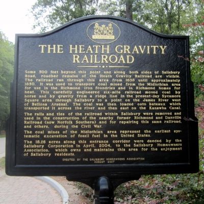
The Heath Gravity Railroad
The rails and ties of the railroad within Salisbury were removed and used in the construction of the nearby former Richmond and Danville Railroad (now Norfolk Southern) and for repairing this same railroad, and others, during the Civil War.
The coal mines of the Midlothian area represent the earliest systematic excavation of fossil fuel in the United States.
The 18.26 acres along this entrance corridor were deeded by the Salisbury Corporation in April, 2004, to the Salisbury Homeowners Association, which owns and maintains this area for the enjoyment of Salisbury residents.
Erected 2007 by Salisbury Homeowners Association.
Topics. This historical marker is listed in these topic lists: Industry & Commerce • Railroads & Streetcars. A significant historical month for this entry is April 2004.
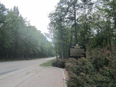
Location. 37° 32.131′ N, 77° 38.243′ W. Marker is in Midlothian, Virginia, in Chesterfield County. Marker is at the intersection of Salisbury Road and Robius Road (Virginia Route 711), on the right when traveling south on Salisbury Road. Touch for map. Marker is in this post office area: Midlothian VA 23113, United States of America. Touch for directions.
Other nearby markers. At least 8 other markers are within 3 miles of this marker, measured as the crow flies. Salisbury (approx. one mile away); Bellona Foundry (approx. 1.9 miles away); Trabue's Tavern (approx. 1.9 miles away); Midlothian Elementary School (approx. 2.2 miles away); Midlothian Coal Mines (approx. 2.3 miles away); a different marker also named Salisbury (approx. 2.3 miles away); Union Raid On Coalfield Station (approx. 2.3 miles away); Winfree Memorial Baptist Church - Midlothian Mine Disaster (approx. 2.4 miles away). Touch for a list and map of all markers in Midlothian.
Also see . . . Mid-Lothian Mines & Rail Roads Foundation. (Submitted on September 6, 2011, by Bernard Fisher of Richmond, Virginia.)
Credits. This page was last revised on June 16, 2016. It was originally submitted on September 6, 2011, by Bernard Fisher of Richmond, Virginia. This page has been viewed 986 times since then and 51 times this year. Photos: 1, 2. submitted on September 6, 2011, by Bernard Fisher of Richmond, Virginia.

