Midlothian in Chesterfield County, Virginia — The American South (Mid-Atlantic)
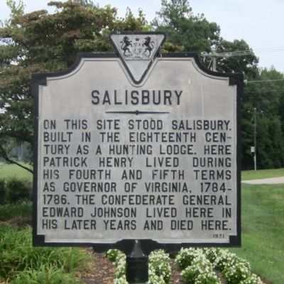
Salisbury
Erected 1971.
Topics. This historical marker is listed in these topic lists: Patriots & Patriotism • War, US Civil.
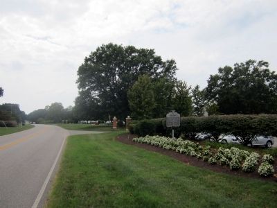
Location. 37° 31.644′ N, 77° 39.144′ W. Marker is in Midlothian, Virginia, in Chesterfield County. Marker is at the intersection of West Salisbury Road and Starcross Road, on the right when traveling south on West Salisbury Road. Touch for map. Marker is at or near this postal address: 13620 West Salisbury Road, Midlothian VA 23113, United States of America. Touch for directions.
Other nearby markers. At least 8 other markers are within 3 miles of this marker, measured as the crow flies. The Heath Gravity Railroad (approx. one mile away); Midlothian Elementary School (approx. 1.4 miles away); Winfree Memorial Baptist Church - Midlothian Mine Disaster (approx. 1.6 miles away); Union Raid On Coalfield Station (approx. 1.7 miles away); a different marker also named Salisbury (approx. 1.7 miles away); Midlothian Coal Mines (approx. 1.7 miles away); Trabue's Tavern (approx. 2 miles away); From Mines to Market (approx. 2.2 miles away). Touch for a list and map of all markers in Midlothian.
Also see . . . Salisbury History. Salisbury Country Club (Submitted on September 6, 2011, by Bernard Fisher of Richmond, Virginia.)
Credits. This page was last revised on June 16, 2016. It was originally submitted on September 6, 2011, by Bernard Fisher of Richmond, Virginia. This page has been viewed 764 times since then and 34 times this year. Photos: 1, 2. submitted on September 6, 2011, by Bernard Fisher of Richmond, Virginia.

