North Blenheim in Schoharie County, New York — The American Northeast (Mid-Atlantic)
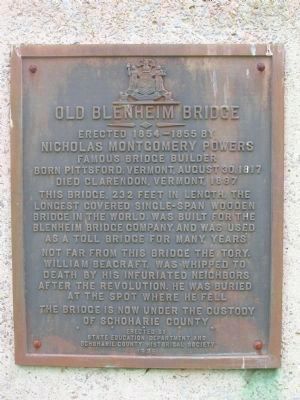
Old Blenheim Bridge
Inscription.
Nicholas Montgomery Powers
Famous bridge builder
Born Pittsford, Vermont, August 30, 1817
Died Clarendon, Vermont, 1897
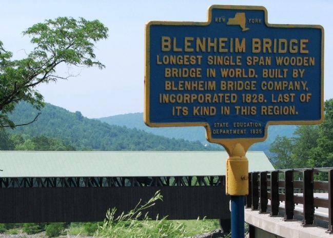
This bridge, 232 feet in length, the
longest covered single-span wooden
bridge in the world, was built for the
Blenheim Bridge Company, and was used
as a toll bridge for many years
Not far from this bridge the Tory,
William Beacraft, was whipped to
death by his infuriated neighbors
after the Revolution. He was buried
at the spot where he fell
The bridge is now under the custody
of Schoharie County
Erected 1935 by New York State Education Department & Schoharie County Historical Society.
Topics and series. This historical marker is listed in these topic lists: Bridges & Viaducts • Roads & Vehicles. In addition, it is included in the ASCE Civil Engineering Landmarks, the Covered Bridges, and the National Historic Landmarks series lists. A significant historical year for this entry is 1854.
Location. 42° 28.354′ N, 74° 26.449′ W. Marker is in North Blenheim, New York, in Schoharie County. Marker is on Eastside Road, on the right when traveling south. This marker, and others, are located beside the east portal of the bridge, just off of NYS Route 30 in North Blenheim, New York. Touch for map. Marker is in this post office area: North Blenheim NY 12131, United States of America. Touch for directions.
Other nearby markers. At least 8 other markers are within walking distance of this marker. Blenheim Bridge (within shouting distance of this marker); a different marker also named Blenheim Bridge (within shouting distance of this marker); The Creation (about 400 feet away, measured in a direct line); The Floods (about 400 feet away); The Life (about 400 feet away); The Re-Creation (about 400 feet away); a different marker also named Old Blenheim Bridge (about 400 feet away); Indian Trail (approx. 0.8 miles away). Touch for a list and map of all markers in North Blenheim.
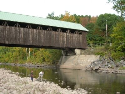
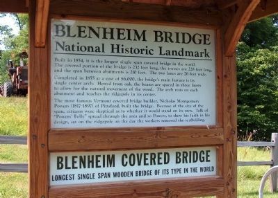
Regarding Old Blenheim Bridge. The Old Blenheim Bridge was located in the Town of Blenheim on State Route 30 in North Blenheim, Schoharie County, New York. It spaned the Schoharie Creek and was "double-barreled" or had two separate lanes. At 232 feet in length between the stone abutments, this bridge had the unique distinction of being "the longest covered single span wooden bridge in the world" and was one of only six remaining bridges in the world with two separated lanes. It was constructed of Long truss with a center arch. The bridge was built in 1854-5 by Nicholas M. Powers under contract for the Blenheim Bridge Company (inc. 1828) as a toll bridge
Photographed By Howard C. Ohlhous, September 27, 2008
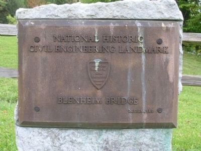
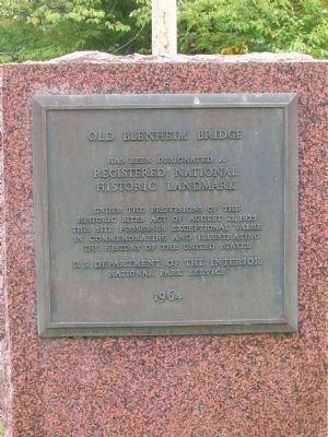
2. National Historic Landmark Marker
has been designated a
Registered National
Historic Landmark
Under the provisions of the
Historic Sites Act of August 21, 1935
This site possesses exceptional value
in commemorating and illustrating
the history of the United States
U.S. Department of the Interior
National Park Service
1964
It's interesting to note that the bridge was not built in place over the Schoharie Creek as most folks would imagine, but rather was assembled at a site nearby, to insure the pieces all fit together correctly. Afterwards it was disassembled and erected in its former location across the creek.
Local lore has it that while the stone abutments were being built one of the masons was sent to fetch a jug of whiskey. Before they got a chance to open the jug and imbibe, the president of the bridge company, J. Dickinson, who was a "teetotaller" (it's an archaic term by today’s standard, a tetotallar being someone who practices and promotes the complete abstinence from alcoholic beverages) arrived unannounced to inspect the progress of the bridge. The masons were forced to hastily hide the jug in the first available spot which happened to be a niche in the abutment. As work proceeded at a quicker pace under the eagle eye of the company president, who wouldn't leave, the masons were forced to build up the stonework around the jug before it was rescued, and supposedly it remains there to this day.
The picturesque old bridge has had many adventures. It has been afire three times and is now insured like any ordinary house. Twice the roof
caught fire from windblown sparks and embers from burning buildings in the village. And once, many years ago, when traveling tinkers went about mending pots and pans, carrying a small charcoal stove to heat their soldering irons, one of these tinkers went so sleep in the bridge and tipped his stove over. The hot coals ignited the wooden bridge but someone happened along in time to put the fire out and to sober up the "tinker" in the nearby river. – Schenectady Union-Star: Feb. 26, 1930
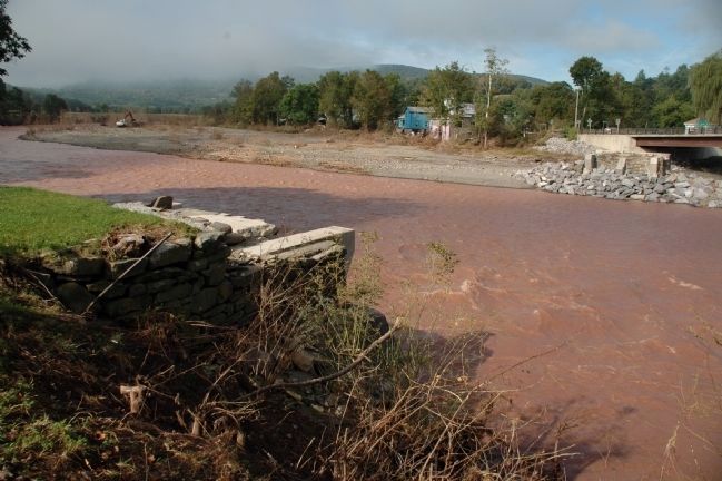
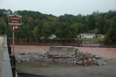
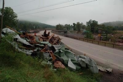
On August 28, 2011, record flooding along the Schoharie Creek, due to Tropical Storm Irene, resulted in the bridge being washed away and completely destroyed.
The Old Blenheim Bridge is listed as a National Historic Landmark and a National Historic Civil Engineering Landmark. See the respective pictures here, and the Blenheim Bridge Marker in the "Other nearby markers" section for more information.
Also see . . . Blenheim Bridge. American Society of Civil Engineers website entry (Submitted on November 1, 2021, by Larry Gertner of New York, New York.)
Additional keywords. Covered Bridge Double Barrel Nicholas Montgomery Powers Tory William Beacraft
Photographed By Howard C. Ohlhous, September 27, 2008
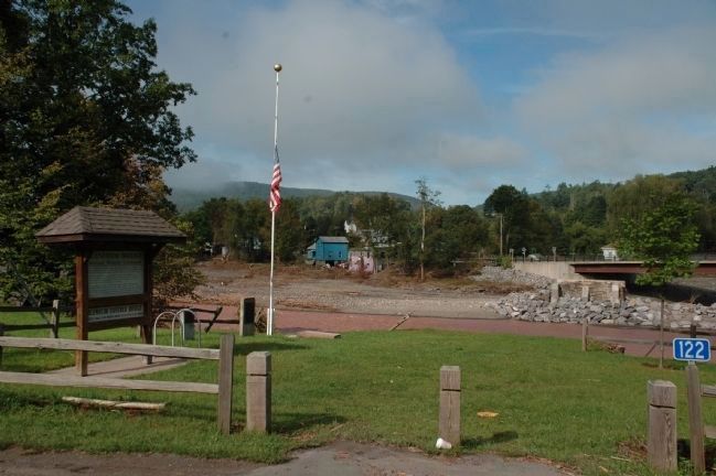
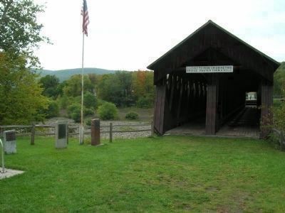
4. Old Blenheim Bridge Markers
All three markers are located beside the east portal of the bridge, just off of NYS Route 30 in North Blenheim, New York. This marker is the center of the three, the National Historic Landmark marker is to the right of the flag pole, and the National Historic Civil Engineering Landmark is on the very left of this photo.
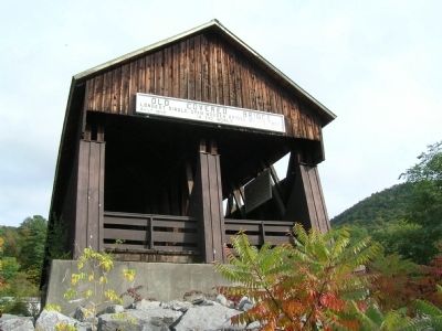
The sign over the bridge reads, "$500 fine to ride or drive this bridge faster than a walk."
The sign over the bridge reads, "$500 fine to ride or drive this bridge faster than a walk."
Photographed By Howard C. Ohlhous, September 27, 2008
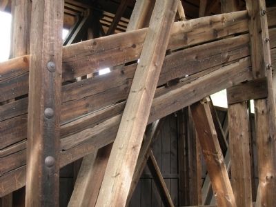
7. Blenheim Bridge Arch Detail
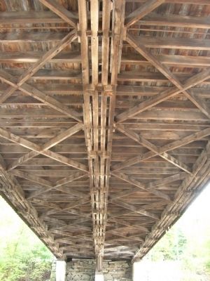
The old Blenheim Bridge is a double barrel bridge, i.e. it has two travel lanes. There is a structural arch and truss-work running down the middle of the bridge which seperates the two travel lanes. The center arch is made up of three concentric arches of wood, carefully blocked apart so that the air can circulate around the wood.
Photographed By Howard C. Ohlhous, September 27, 2008
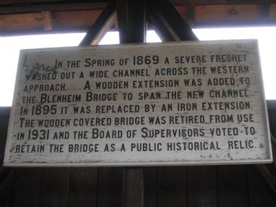
9. Sign Inside the Old Blenheim Bridge
This sign is mounted on the north wall of the bridge, just inside the west portal. It reads as follows:
In the Spring of 1869 a sever freshet
washed out a wide channel across the western
approach. A wooden extensioin was added to
the Blenheim Bridge to span the new channel.
In 1895 it was replaced by an iron extension.
The wooden Covered Bridge was retired from use
in 1931 and the Board of Supervisors voted to
retain the bridge as a public historial relic.
Credits. This page was last revised on November 1, 2021. It was originally submitted on September 28, 2008, by Howard C. Ohlhous of Duanesburg, New York. This page has been viewed 2,492 times since then and 26 times this year. Last updated on September 10, 2011, by Howard C. Ohlhous of Duanesburg, New York. Photos: 1, 2, 3, 4, 5, 6, 7, 8, 9. submitted on September 28, 2008, by Howard C. Ohlhous of Duanesburg, New York. 10, 11. submitted on September 10, 2011, by Howard C. Ohlhous of Duanesburg, New York. 12. submitted on April 7, 2014, by Cosmos Mariner of Cape Canaveral, Florida. 13, 14. submitted on September 10, 2011, by Howard C. Ohlhous of Duanesburg, New York. 15. submitted on April 7, 2014, by Cosmos Mariner of Cape Canaveral, Florida. • Bill Pfingsten was the editor who published this page.
