Topeka in Shawnee County, Kansas — The American Midwest (Upper Plains)
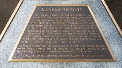
Kansas History
The first Spanish explorers arrived in Kansas in 1541, followed by Lewis and Clark in 1804. Westward migration brought the first white settlers - government agents in 1808 and missionaries in 1825. Oil and gas were discovered in 1851. In 1854, Kansas became a territory with a population of 1,500 white people. On January 29, 1861, Kansas entered the Union as the 34th state with a constitution that prohibits slavery. In 1862, Kansas passed the Homestead Act. Homesteaders could claim 160 acres of land by living on it for five years.
Kansas is named for the Kansa tribe, whose name means People of the Wind. Famous for its farming, oil, aircraft industry, and modern cities, Kansas is a proud, forward-looking state.
Erected by Paul and Karma Aylward.
Topics. This historical marker is listed in these topic lists: Exploration • Government & Politics • Native Americans • Settlements & Settlers. A significant historical date for this entry is January 29, 1861.
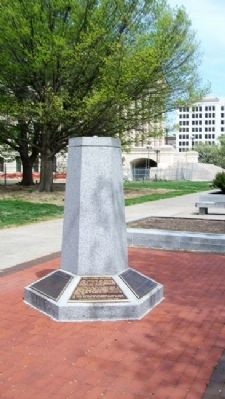
Location. 39° 2.863′ N, 95° 40.751′ W. Marker is in Topeka, Kansas, in Shawnee County. Marker is on the west grounds of the state Capitol, near SW Harrison Street and about 300 feet west of the SW entrance to the Capitol. Touch for map. Marker is at or near this postal address: 300 SW 10th Avenue, Topeka KS 66612, United States of America. Touch for directions.
Other nearby markers. At least 8 other markers are within walking distance of this marker. The Capitol Building (here, next to this marker); The Governor's Plaque (here, next to this marker); Kansas Children (here, next to this marker); The Kansa Tribe (here, next to this marker); Ad Astra Dedication Ceremony (here, next to this marker); Pioneer Women of Kansas (a few steps from this marker); Governor Landon's Acceptance (about 300 feet away, measured in a direct line); Charles Curtis (about 300 feet away). Touch for a list and map of all markers in Topeka.
Also see . . .
1. History of Kansas. Wikipedia entry (Submitted on January 23, 2021, by Larry Gertner of New York, New York.)
2. State of Kansas. Official Website (Submitted on September 10, 2011, by William Fischer, Jr. of Scranton, Pennsylvania.)
Credits. This page was last revised on January 23, 2021. It was originally submitted on September 10, 2011, by William Fischer, Jr. of Scranton, Pennsylvania. This page has been viewed 549 times since then and 14 times this year. Photos: 1, 2. submitted on September 10, 2011, by William Fischer, Jr. of Scranton, Pennsylvania.

