Topeka in Shawnee County, Kansas — The American Midwest (Upper Plains)
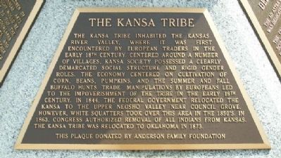
The Kansa Tribe
The Kansa tribe inhabited the Kansas River Valley, where it was first encountered by European traders in the early 18th century. Centered around a number of villages, Kansa society possessed a clearly demarcated social structure and rigid gender roles. The economy centered on cultivation of corn, beans, pumpkins, and the summer and fall buffalo hunts. Trade manipulations by Europeans led to the impoverishment of the tribe in the early 19th century. In 1844, the federal government relocated the Kansa to the Upper Neosho Valley near Council Grove. However, white squatters took over this area in the 1850's. In 1863, Congress authorized removal of all Indians from Kansas. The Kansa tribe was relocated to Oklahoma in 1873.
Erected by Anderson Family Foundation.
Topics. This historical marker is listed in this topic list: Native Americans. A significant historical year for this entry is 1844.
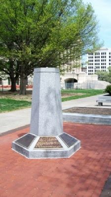
Location. 39° 2.863′ N, 95° 40.751′ W. Marker is in Topeka, Kansas, in Shawnee County. Marker is on the west grounds of the state Capitol, near SW Harrison Street and about 300 feet west of the SW entrance to the Capitol. Touch for map. Marker is at or near this postal address: 300 SW 10th Avenue, Topeka KS 66612, United States of America. Touch for directions.
Other nearby markers. At least 8 other markers are within walking distance of this marker. The Capitol Building (here, next to this marker); Kansas History (here, next to this marker); The Governor's Plaque (here, next to this marker); Kansas Children (here, next to this marker); Ad Astra Dedication Ceremony (here, next to this marker); Pioneer Women of Kansas (a few steps from this marker); Governor Landon's Acceptance (about 300 feet away, measured in a direct line); Charles Curtis (about 300 feet away). Touch for a list and map of all markers in Topeka.
Also see . . .
1. The Kaw (Kansa) Nation. (Submitted on September 10, 2011, by William Fischer, Jr. of Scranton, Pennsylvania.)
2. Kansa Village. (Submitted on September 10, 2011, by William Fischer, Jr. of Scranton, Pennsylvania.)
3. Kansa Tribe History. (Submitted on September 10, 2011, by William Fischer, Jr. of Scranton, Pennsylvania.)
Credits. This page was last revised on June 16, 2016. It was originally submitted on September 10, 2011, by William Fischer, Jr. of Scranton, Pennsylvania. This page has been viewed 600 times since then and 17 times this year. Photos: 1, 2. submitted on September 10, 2011, by William Fischer, Jr. of Scranton, Pennsylvania.

