Elizabethton in Carter County, Tennessee — The American South (East South Central)
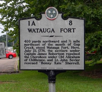
Watauga Fort
Erected by Tennessee Historical Commission. (Marker Number 1A 8.)
Topics and series. This historical marker is listed in these topic lists: Colonial Era • Forts and Castles • Settlements & Settlers. In addition, it is included in the Tennessee Historical Commission series list. A significant historical month for this entry is July 1876.
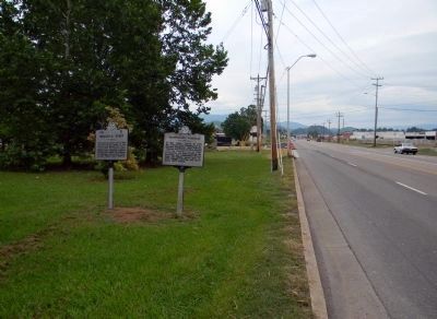
Location. 36° 20.622′ N, 82° 15.023′ W. Marker is in Elizabethton, Tennessee, in Carter County. Marker is on West Elk Avenue (U.S. 321) west of Franklin Club Drive, on the right when traveling west. The marker is on the edge of the Sycamore Shoals State Historic Area. Touch for map. Marker is at or near this postal address: 1651 West Elk Avenue, Elizabethton TN 37643, United States of America. Touch for directions.
Other nearby markers. At least 8 other markers are within walking distance of this marker. Transylvania Purchase (here, next to this marker); Watauga Purchase (a few steps from this marker); Sycamore Shoals of the Watauga (within shouting distance of this marker); a different marker also named Sycamore Shoals of the Watauga (within shouting distance of this marker); Valentine Sevier, "The Immigrant" (approx. 0.2 miles away); Bemberg Station / Port Rayon (approx. 0.6 miles away); Bemberg Water Tower (approx. 0.7 miles away); Monument to the Patriots (approx. 0.9 miles away). Touch for a list and map of all markers in Elizabethton.
More about this marker. Watauga Fort is also identified as Fort Watauga or Fort Caswell in various publications.
Also see . . . TN State Parks: Sycamore Shoals State Park: Historic Park. Sycamore Shoals played a significant role in 18th-Century history as the setting for some of the most dramatic events to occur in the expansion of America's western boundary. (Submitted on September 15, 2011, by PaulwC3 of Northern, Virginia.)
Credits. This page was last revised on September 2, 2020. It was originally submitted on September 15, 2011, by PaulwC3 of Northern, Virginia. This page has been viewed 1,135 times since then and 22 times this year. Photos: 1, 2. submitted on September 15, 2011, by PaulwC3 of Northern, Virginia.
Editor’s want-list for this marker. Photos of the recreation of Fort Watauga at the Sycamore Shoals State Historic Area. • Can you help?

