Grove Hill in Clarke County, Alabama — The American South (East South Central)
Grove Hill, Alabama
Front:
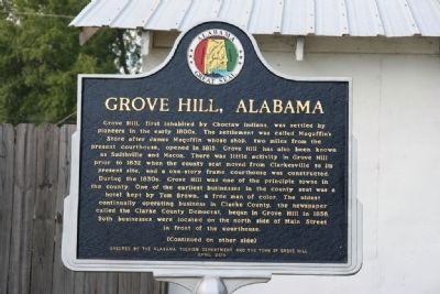
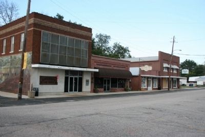
Grove Hill, first inhabited by Choctaw Indians, was settled by pioneers in the early 1800s. The settlement was called Magoffin's Store after James Magoffin whose shop, two miles from the present courthouse, opened in 1815. Grove Hill has also been known as Smithville and Macon. There was little activity in Grove Hill prior to 1832 when the county seat moved from Clarksville to its present site, and a one-story frame courthouse was constructed. During the 1830s, Grove Hill was one of the principle towns in the county. One of the earliest businesses in the county seat was a hotel kept by Tom Brown, a free man of color. The oldest continually operating business in Clarke County, the newspaper called the Clarke County Democrat, began in Grove Hill in 1856. Both business were located on the north side of Main Street in front of the Courthouse.
(Continued on other side)
Reverse:
(Continued from other side)
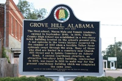
The first school, Macon Male and Female Academy, opened in September 1846. In 1909, Clarke County High School was established in a two-story brick building located on the school's present site.
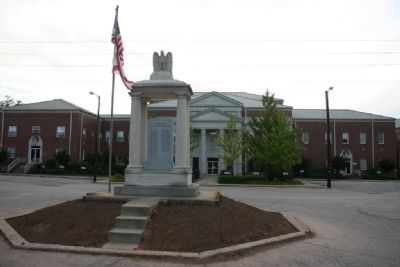
A sad episode in the town's history occurred in the summer of 1853 when a terrible Yellow Fever epidemic swept through the area. Many of those who died are buried in a cemetery near Church Hill Street and in Spinks Cemetery on Asbury Road. A second courthouse structure, an attractive two-story brick building, constructed in 1899, was razed in 1955 to make way for the present courthouse building which was completed the same year.
Erected 2010 by The Alabama Tourism Department and the Town of Grove Hill.
Topics. This historical marker is listed in this topic list: Settlements & Settlers. A significant historical month for this entry is September 1846.
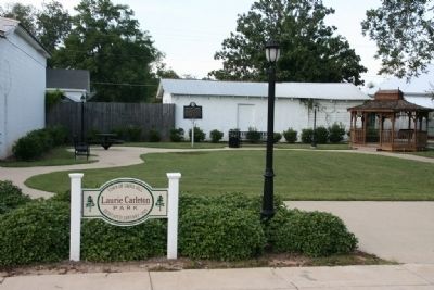
Location. 31° 42.564′ N, 87° 46.67′ W. Marker is in Grove Hill, Alabama, in Clarke County. Marker can be reached from the intersection of Main Street and Court Street. Marker stands in the Laurie Carleton Park next to the posted address. Touch for map. Marker is at or near this postal address: 132 Main Street, Grove Hill AL 36451, United States of America. Touch for directions.
Other nearby markers. At least 8 other markers are within walking distance of this marker. Clarke County Courthouse (within shouting distance of this marker); Clarke County Soldiers Of The American Revolution (about 400 feet away, measured in a direct line); Colored and White Soldiers of World War I (about 400 feet away); The Alston-Cobb House (about 400 feet away); Josiah and Lucy Martin Mathews Cabin (about 400 feet away); Turner Corncrib (about 400 feet away); Salt Pans and Furnaces (about 500 feet away); Creagh Law Office (about 500 feet away). Touch for a list and map of all markers in Grove Hill.
Also see . . .
1. Grove Hill. Encyclopedia of Alabama website entry (Submitted on September 24, 2021, by Larry Gertner of New York, New York.)
2. History of The Clark County Democrat. Newspaper website entry (Submitted on September 27, 2011, by Timothy Carr of Birmingham, Alabama.)
Credits. This page was last revised on September 24, 2021. It was originally submitted on September 27, 2011, by Timothy Carr of Birmingham, Alabama. This page has been viewed 1,369 times since then and 51 times this year. Photos: 1, 2, 3, 4, 5, 6. submitted on September 27, 2011, by Timothy Carr of Birmingham, Alabama. • Bill Pfingsten was the editor who published this page.
