Near Francisco in Gibson County, Indiana — The American Midwest (Great Lakes)
Wabash & Erie Canal
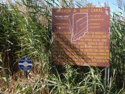
( At Top - - Canal Map & Points of Interest )
Here is a section of the Wabash & Erie Canal still visible in Gibson County. Construction of the approx. 460 mi. canal. The longest in North America. Began in 1832 & was completed in 1853. One worker for every 6ft. Of the canal died during the construction connecting Lake Erie at Toledo, Ohio with the Ohio River at Evansville. The canal was an important means of transportation and commerce which was eventually replaced with the introduction of railroads.
Topics and series. This historical marker is listed in these topic lists: Agriculture • Industry & Commerce • Settlements & Settlers • Waterways & Vessels. In addition, it is included in the Wabash & Erie Canal series list. A significant historical year for this entry is 1832.
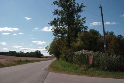
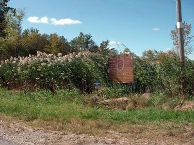
Location. 38° 19.684′ N, 87° 27.889′ W. Marker is near Francisco, Indiana, in Gibson County. Marker is at the intersection of County Road 550E and County Road 175S, on the left when traveling south on County Road 550E. Touch for map. Marker is in this post office area: Francisco IN 47649, United States of America. Touch for directions.
Other nearby markers. At least 8 other markers are within 6 miles of this marker, measured as the crow flies. Welborn-Ross (House) (approx. 5.8 miles away); South Princeton Historic District (approx. 5.9 miles away); Gibson County Civil War Memorial (approx. 5.9 miles away); Gibson County Desert Storm and Desert Shield Veterans Memorial (approx. 5.9 miles away); Gibson County Korean - Vietnam Honor Rolls (approx. 5.9 miles away); Gibson County World Wars I and II Honor Roll (approx. 5.9 miles away); Gibson County American Revolution Honor Roll (approx. 5.9 miles away); Civil War Honor Roll Memorial (approx. 5.9 miles away).
Regarding Wabash & Erie Canal. The tall greenery all along the water-way of the 'Canal' obstructed any ability to photograph the existing canal. However, what could be seen was quite impressive of the general nature of 'the canal'. The water was very high at the time of photographing.
Photos are desire when the greenery is less tall. Please photograph and attach when you can ! ! Just attach by using the above "Add Photo" hot button - and add comments too.!!
Also see . . .
1. "The Men who dug the Canal"::. A light and lively song with many old photos of canal builders in the process of digging a canal. (Submitted on October 3, 2011, by Al Wolf of Veedersburg, Indiana.)
2. "Angel of the Canal" ::. Many fell ill digging canals. In frontier days there were
few doctors and medicine was scarce. In the Brecksville, Ohio area Mrs. Johnson became known as the "Angel of the Canal" for her care of the ill. (Submitted on October 3, 2011, by Al Wolf of Veedersburg, Indiana.)
Credits. This page was last revised on June 16, 2016. It was originally submitted on October 3, 2011, by Al Wolf of Veedersburg, Indiana. This page has been viewed 895 times since then and 51 times this year. Photos: 1, 2, 3, 4. submitted on October 3, 2011, by Al Wolf of Veedersburg, Indiana. • Bill Pfingsten was the editor who published this page.


