Near Camden in Kershaw County, South Carolina — The American South (South Atlantic)
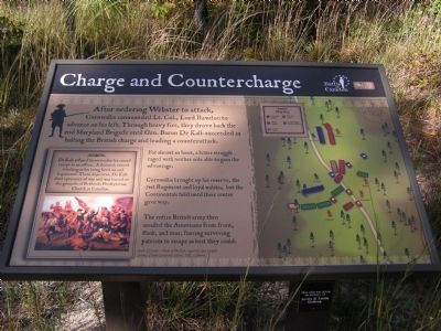
Charge and Countercharge
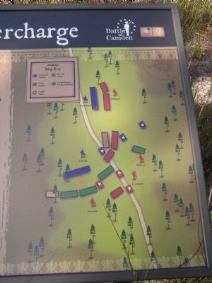
For almost an hour, a bitter struggle raged with neither side able to gain the advantage.
Cornwallis brought up his reserve, the 71st Regiment and loyal militia, but the Continentals held until their center gave way.
The entire British army then assailed the Americans from front, flank, and rear, forcing surviving patriots to escape as best they could.
Erected by The Palmetto Conservation Foundation. (Marker Number 9.)
Topics. This historical marker is listed in this topic list: War, US Revolutionary.
Location. 34° 21.208′ N, 80° 36.546′ W. Marker is near Camden, South Carolina, in Kershaw County. Marker can be reached from Flat Rock Road (State Highway 58). 6.2 miles North of Camden off US 521 and 601 on SC 58. Touch for map. Marker is in this post office area: Camden SC 29020, United States of America. Touch for directions.
Other nearby markers. At least 8 other markers are within walking distance of this marker. All the King's Men (about 400 feet away, measured in a direct line); Attack at Dawn (about 700 feet away); Shots in the Dark (approx. 0.2 miles away); Meet the American Army of 1780 (approx. 0.2 miles away); Defeat in the Center (approx. 0.2 miles away); Driven from the Field (approx. ¼ mile away); The Road to Battle (approx. ¼ mile away); Panic and Valor (approx. ¼ mile away). Touch for a list and map of all markers in Camden.
More about this marker. This marker is part of an interpretive trail series at the Battle of Camden National Historic Landmark.

Photographed By Anna Inbody, October 2, 2011
3. Picture on the marker
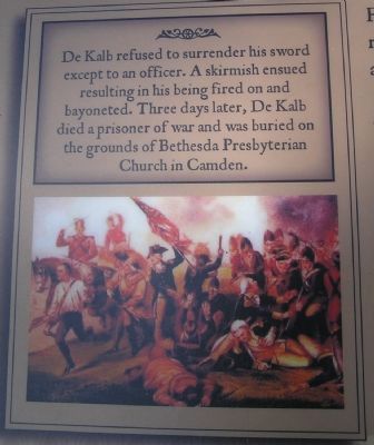
De Kalb refused to surrender his sword except to an officer. A skirmish ensued resulting in his being fired on and bayoneted. Three days later, De Kalb died a prisoner of war and was buried on the grounds of Bethesda Presbyterian Church in Camden.
Battle of Camden ~ Death of De Kalb, engraving after Chappel. Courtesy of South Caroliniana Library, USC, Columbia (SC).
Credits. This page was last revised on June 16, 2016. It was originally submitted on October 9, 2011, by Anna Inbody of Columbia, South Carolina. This page has been viewed 550 times since then and 19 times this year. Photos: 1, 2, 3, 4. submitted on October 9, 2011, by Anna Inbody of Columbia, South Carolina. • Craig Swain was the editor who published this page.


