Vernon in Windham County, Vermont — The American Northeast (New England)
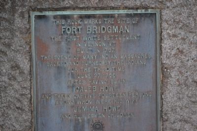
Fort Bridgman
Fort Bridgman
The first white settlement
In Vernon, Vt. Built in 1737,
The scene of many Indian massacres
Sacked and burned by the Indians
For the third time
June 27, 1755,
After having slain
Caleb Howe
And taken captive fourteen persons
Among whom were his wife
Jemima Howe
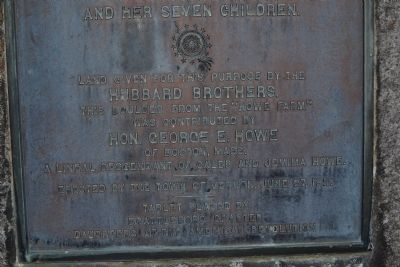
And her seven children.
Land given for this purpose by the
Hubbard Brothers
This boulder from the “Howe Farm”
Was contributed by
Hon. George E. Howe
of Boston, Mass.
A lineal descendant of Caleb and Jemima Howe
Erected by the town of Vernon, June 27, 1911.
Tablet placed by
Brattleboro Chapter
Daughters of the American Revolution
Erected 1911 by Brattleboro Chapter Daughters of the American Revolution (DAR).
Topics and series. This historical marker is listed in these topic lists: Colonial Era • Forts and Castles. In addition, it is included in the Daughters of the American Revolution series list. A significant historical month for this entry is June 1784.
Location. 42° 47.394′ N, 72° 31.938′ W. Marker is in Vernon, Vermont, in Windham County. Marker is on Fort Bridgman Road (Route 142) ¼ mile north of Hubbard Road, on the left when traveling south. Touch for map. Marker is at or near this postal address: 1297 Fort Bridgman Road, Vernon VT 05354, United States of America. Touch for directions.
Other nearby markers. At least 8 other markers are within 3 miles of this marker, measured as the crow flies. Jemima Tute (approx. 0.2 miles away); George's Mill (approx. 2.1 miles away); a different marker also named George's Mill (approx. 2.1 miles away); Historic Vernon Union Church (approx. 2.2 miles away); Central Park (approx. 2.3 miles away); Vermont’s Interstate Highway System (approx. 2.3 miles away); Abijah and Lucy Terry Prince (approx. 2.4 miles away); Hinsdale, New Hampshire Post Office (approx. 2.6 miles away in New Hampshire). Touch for a list and map of all markers in Vernon.
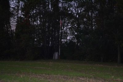
More about this marker. The marker is beyond the field, under an American flag.
Credits. This page was last revised on March 19, 2024. It was originally submitted on October 9, 2011, by Mick Secord of West Chesterfield, New Hampshire. This page has been viewed 1,145 times since then and 64 times this year. Last updated on February 13, 2024, by Carolyn Sanders of Plano, Texas. Photos: 1, 2, 3, 4. submitted on October 9, 2011, by Mick Secord of West Chesterfield, New Hampshire. • J. Makali Bruton was the editor who published this page.


