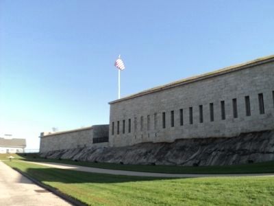
Fort Trumbull in New London in New London County, Connecticut — The American Northeast (New England)
The Third System
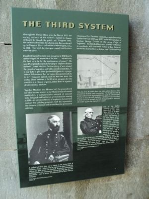
Although the United States won the War of 1812, the searing memory of the nationís capital in flames continued to disturb the public and Congress alike. The British had entered the Chesapeake Bay, continued up the Potomac River, and set fire to Washington, D.C., in 1814. The need for stronger coastal fortifications was very clear.
President James Madison told Congress in 1815 that “a certain degree of preparation for war . . . affords also the best security for the continuance of peace.” He urged Congress to support funding to “improve harbor defense.” James Monroe, then secretary of war, shared the presidentís opinion and told a Senate committee, “It is our duty to put these [vulnerable] ports in a proper state of defense now that we have a fair opportunity to do it.” Congress agreed, and for the first time, the United States initiated a fortification program for the coastline in a climate of peace, rather than in a period of international tensions.
Together Madison and Monroe laid the groundwork for what became known as the Third System of coastal fortification, a comprehensive network of seacoast forts, designed and build over several decades starting in 1816. An appointed board of engineers planned and oversaw the building program, with the expectation that the new system of forts would become permanent defenses.
The present Fort Trumbull was built as part of the Third System between 1839 and 1852, under the direction of Captain George Cullum of the Army Corps of Engineers. The Board of Engineers planned for this fort to coordinate with the water battery at Fort Griswold across the Thames River to defend New London Harbor.
Erected by Fort Trumbull State Park.
Topics and series. This historical marker is listed in this topic list: Forts and Castles. In addition, it is included in the Former U.S. Presidents: #04 James Madison, and the Former U.S. Presidents: #05 James Monroe series lists. A significant historical year for this entry is 1812.
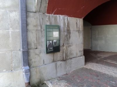
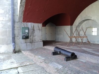
Location. 41° 20.61′ N, 72° 5.602′ W. Marker is in New London, Connecticut, in New London County. It is in Fort Trumbull. Marker can be reached from East Street, on the left when traveling south. Marker is located inside the fort at Fort Trumbull State Park. Touch for map. Marker is in this post office area: New London CT 06320, United States of America. Touch for directions.
Other nearby markers. At least 8 other markers are within walking distance of this marker. War of 1812 (here, next to this marker); American Revolution (here, next to this marker); Fort Interiors (here, next to this marker); Civil War (a few steps from this marker); Coast Guard (a few steps from this marker); Post Civil War to 1910 (a few steps from this marker); ďAim, Load, FireĒ (a few steps from this marker); Scientific Research (within shouting distance of this marker). Touch for a list and map of all markers in New London.
More about this marker. A portrait of Capt. Cullum appears at the lower left of the marker and has a caption of “A graduate of West Point and a captain in the Army Corps of Engineers, George Cullum served as engineer-in-charge during the construction of the present Fort Trumbull. He directly supervised the building process and continuously requested funding from the War Department. Later he became the superintendent of West Point for two years.”
The lower right features a portrait of Joseph Totten. It has the caption “One of the leading American military engineers of all time, Joseph Totten served on the Board of Engineers from its start in 1816 and continued on the board almost without interruption for more than two decades. Thereafter, in 1838, he became chief engineer, commanding the Army Corps of Engineers until his death in 1864. Totten developed a way to reduce the size of embrasures, the openings in a fortís walls for firing guns, while allowing the guns a wider range of movement. He exerted so much influence on the design and implementation of the Third System of coastal fortification that it is sometimes called the Totten System. Totten was a native of New Haven, Connecticut, and graduated from West Point in 1805.” The two photos were provided by the US. Military History Institution, Carlisle, PA.
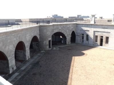
Above the picture of Totten is a map of Fort Trumbull, and has a caption of “This plan from the 1840s shows two walls and two bastions of the present Fort Trumbull under construction. Fort Trumbull is made of granite with two levels of gun positions, one inside the fort (casemate) and one on top of the walls (barbette). Third System forts were built in stone or brick for strength, and with tiered gun positions to increase the number of guns that could fire on a target.”
Also see . . . History of Fort Trumbull. Friends of Fort Trumbull website. (Submitted on October 15, 2011, by Bill Coughlin of Woodland Park, New Jersey.)
Credits. This page was last revised on February 10, 2023. It was originally submitted on October 15, 2011, by Bill Coughlin of Woodland Park, New Jersey. This page has been viewed 516 times since then and 9 times this year. Photos: 1, 2, 3, 4, 5. submitted on October 15, 2011, by Bill Coughlin of Woodland Park, New Jersey.
