Hastings in Dakota County, Minnesota — The American Midwest (Upper Plains)
Hastings Grows
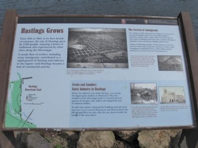
A steady flow of settlers, including many immigrants, contributed to a rapid growth of farming and industry in the region — and Hastings became a hub of commercial activity.
The Arrival of Immigrants
The treaties of 1851 relocated the Dakota to reservations, opening abundant land west of the Mississippi to settlement. Many of the early settlers were immigrants who came to Hastings primarily from northern European countries such as Germany, Ireland, and Sweden.
Drawn to Hastings because of its location on the river and the fertile and inexpensive farmland nearby, many immigrants established farms, while others started businesses or found work in the growing city.
Grain and Lumber:
Early Industry in Hastings
Before the railroads were built, Hasting was among the largest grain markets in Minnesota. The city's location on the Mississippi made it a natural spot for grain to be bought, sold, milled, and shipped by river to national markets.
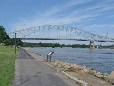
To meet the settlers' demand for building material, pine logs were cut in central Minnesota and floated down the Mississippi River in rafts, like the one shown beside the bridge in the view above.
Erected by City of Hastings; National Park Service, U.S. Department of the Interior, Mississippi National River and Recreation Area.
Topics. This historical marker is listed in these topic lists: Industry & Commerce • Native Americans • Settlements & Settlers • Waterways & Vessels. A significant historical year for this entry is 1856.
Location. 44° 44.745′ N, 92° 50.988′ W. Marker is in Hastings, Minnesota, in Dakota County. Marker can be reached from the intersection of 1st Street and Ramsey Street. Marker is along the Hastings Riverfront Trail in Veteran’s Memorial Levee Park. Touch for map. Marker is in this post office area: Hastings MN 55033, United States of America. Touch for directions.
Other nearby markers. At least 8 other markers are within walking distance of this marker. Veterans Memorial Levee (within shouting distance of this marker); Mississippi (within shouting distance of this marker); Steamboats, Trains, and Barges (about 300 feet away, measured in a direct line); Spiral Bridge (about 300 feet away); Hastings Spiral Bridge (about 400 feet away); Gardner House Hotel (about 500 feet away); American Legion Veterans Memorial (about 500 feet away); The Pringle Hardware Building (about 500 feet away). Touch for a list and map of all markers in Hastings.
More about this marker. [photo captions, clockwise]
• This birdseye view shows the city of Hastings taking shape. Steamboats load and unload at the public levee, and farms stretch to the horizon. City of Hastings
• Henry Hach and his wife Anna Maria, both German immigrants, arrived from the state of New York in 1864. Like many immigrants, they brought a craft or a trade with them. They started their shoe business in this shop on Vermillion Street. City of Hastings
• By the 1870s, elevators and warehouses dotted the landscape of the levee, near where you are standing. City of Hastings
• The rafts supplied riverside sawmills including the Libbey Mill, shown here, which stood just west of the bridge. With steam power and the circular saw, a mill could produce 100 wagon loads of lumber a day. City of Hastings
Credits. This page was last revised on November 21, 2020. It was originally submitted on October 15, 2011, by Keith L of Wisconsin Rapids, Wisconsin. This page has been viewed 610 times since then and 23 times this year. Photos: 1, 2. submitted on October 15, 2011, by Keith L of Wisconsin Rapids, Wisconsin. 3. submitted on May 14, 2014, by Keith L of Wisconsin Rapids, Wisconsin.


